| Home | Rides | Reviews | Bikes | Gallery | Tech | Misc | Contact |
| Tour of Idaho 2010 by Martin Hackworth Photos: Martin Hackworth, Dan Colvin |
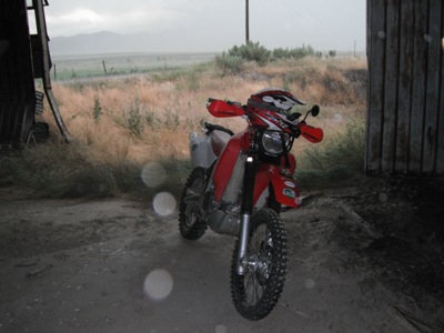
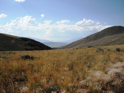
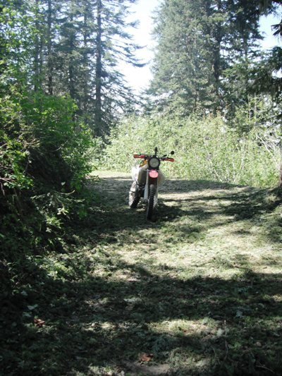
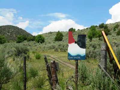 Mile Marker 0. Photo: Dan
Colvin
|
|
|
|
The Tour of Idaho is in historic good shape this year. If you ever had
aspirations of doing the Tour 2010 is the time. Most of the roads and
atv trails are immaculate and buff. I think I know where a good chunk
of all that federal stimulus money went. Because most MoJazz staffers are lucky enough to live in very close proximity to both T1 and T2 we get to ride sections of both Tours all of the time. Our biggest issue is just getting the time to ride which also explains our recent proclivity for high-speed one and two day blitzes of portions of the Tour. Necessity is the mother of invention. This year we were fortunate enough to have our friends at Pocatello Power Sports build us a project CRF450X especially for the Tour of Idaho. After a 14-hour run of T2 in mid-July we felt that we had the CRFX well enough sorted out to see how it would do on the longer, much harder on bikes, T1. I also had plenty of time this year to plan for a solo ride at a leisurly pace. |
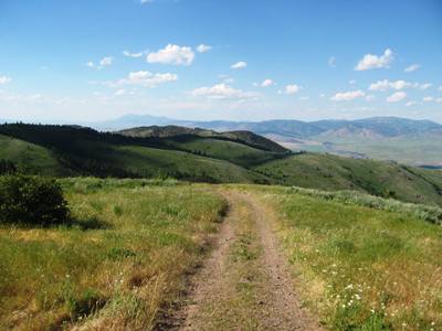 Oxford Basin. Photo: Martin Hackworth |
|
While the new CRF was being prepped for the Tour at Power
Sports
I rode Day 1, on the 25th of July, on my old faithful XR650R -
"Bodacious." I was a little curious to see if I could beat my
Jenkins Hollow to Pocatello time from last year during my 32-hour blitz
from Jenkins Hollow to Wallace on the same bike (I could not). A late
in the day start meant that I was rolling into Pocatello around dark
and the view of the lights in the Portneuf valley upon cresting the
summit of Chinese Peak from the darkness of Blackrock Canyon was a
visual treat even for someone who gets to see it all of the
time. A few days later I did the 100-mile Pocatello to American Falls section as an afternoon ride. The portion up and over Wild Horse Divide and through Arbon Valley was uneventful but wild thunderstorms rolled over the Sublett range as I came down Big Canyon into Rockland Valley. My Blackberry chirped to call attention to a weather alert and the radar image showed that I was directly in the path of a large and intense thunderstorm with high winds and lightning. I found an abandoned implement shed by the side of the Flint Canyon road just as the gust front was passing and the first drops |
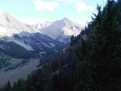
 The Boundary Trail - Kelly Gulch. Photo: Martin Hackworth |
| were
beginning to fall. I spend the better part of the next hour inside
the shed watching
lightning bolts crash
all around and rain come down in waves. The leaky roof of the shed
meant that the downpour was just slightly less intense inside. After an hour or so the storm passed and I resumed riding up Flint Canyon. One of my favorite portions of T1 is the Sublett Range. This year even the road up Dairy Canyon is freshly graded and the long descent into Fall Creek was lush and beautiful. I dodged more thunderstorms rolling into American Falls where a shuttle back to Pocatello awaited. A few days later, on July 31, the CRFX was finally ready and I set off from American Falls at about 3 p.m. It's been awhile since I toured the gravel and dirt roads and wagon ruts out to Big Southern Butte in daylight and I'd forgotten how much I really enjoy this section of the ride. The road to the top of the Butte was nearly immaculate and the round trip, including photos and a phone call or two, took less than an hour. |
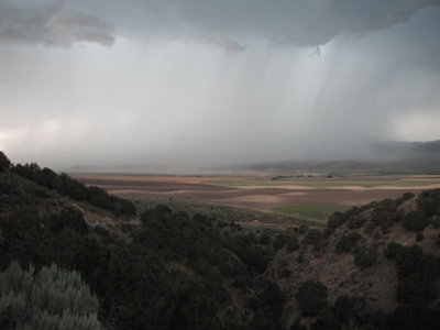 Storm in Rockland Valley. Photo: Martin Hackworth |
|
The remaining miles into
Arco passed swiftly and pleasantly and I was climbing Beverland Pass by
5 p.m. An hour or so later I found myself parked in a light rain along
Dry Creek Road at the junction with the road up Long Lost Creek that
leads to one of the major challenges of the entire Tour - the
Massacre Mountain Loop. Massacre Mountain Loop (a.k.a. the Swauger Lakes Trail) is a 16.5 mile loop that is as spectacular and essential as it can be dangerous. When done in it's entirety the climb out of Long Lost Creek up to the divide between the Long Lost and Dry Creek headwaters is... an adventure. This year the trail up is mostly single track with some hairball switchbacks that must be negotiated without falling off your bike. The consequences of a tip over in a few spots are just about too awful to even consider. I think that it might take a long time to rescue yourself and your bike from such a predicament. Once above the burly stuff I had the opportunity to relax and shoot some video of the scenic ride through alpine terrain to the divide at 9613' just above Copper Lake. |
 Shelter from a Storm. Photo: Martin Hackworth |
|
I had a silly get-off descending the atv trail around Swauger
Lakes. I came over a rise with the glare from the setting sun right in
my face and failed to negotiate a rutted turn. The resulting
trunk-thumper left me with a grapefruit-sized bruise under the armor on
my right elbow and some bent Acrebis handguards to deal with. Better
there than a few miles back. The twilight climb over the Pahsimeroi Crest was an absolute treat with more wild thunderstorms off in the distance to the north. The bike was running well, I had plenty of gas left, I was feeling great and would arrive at the Challis RV Park Motel uncharacteristically early after a 240 mile day. The only bad news is that everything in Challis rolls up pretty early (Donna, the proprietor of the Challis RV Park, just left my key in my room) so I had to satisfy myself with trail snacks for dinner. A word about the Challis RV Park and Motel - it's the cleanest, nicest place you can imagine. The rooms are large, the beds are comfortable, heck - the linen even smells good. I spend several hours texting friends and updating the MoJazz Facebook page with my Blackberry before turning in. |
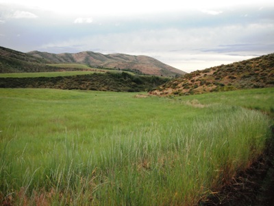 Fall Creek, Sublett Range. Photo: Martin Hackworth |
|
I lingered
over breakfast the next morning and leisurely picked out fresh
trail snacks before rolling out of Challis for Twin Peaks LO.
I elected to take the
regular route north
along Challis Creek and do an out and back to the lookout from Challis
Creek Road. It was a clear day and the views from the summit (10,330)
were spectacular. Twin Peaks lookout sits atop one of the highest roads
in Idaho. I've driven a SUV up to the lookout before but I'd swear that
the road gets narrower and the switchbacks tricker each time I make the
climb. I talked with Mike, the spotter manning the lookout, for about
an hour and he claimed to have seen something curious - as in
unusually bright - on the Pahsimeroi crest just after sunset the night
before. One hundred watts of HID lighting? I shot some video of the descent with my new Fujifilm Finepix XP10 camera. Then it was a quick dash back down Challis Creek to Darling Creek Road and the sprint toward Shoup. It appears that the Panther Creek Inn is no more due to Superfund style heavy metal abatement along Panther Creek (or if it's still there I missed it). I rolled into Shoup a little after noon. The Shoup Store is under new management for the umpteenth time and not open every day (closed Monday for sure). After a brief respite I headed toward Spring Creek Road (NFD 044) and the Montana-Idaho border. The helicopter buzzing overhead should have portended trouble. |
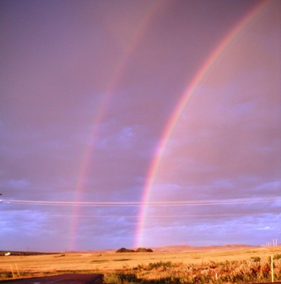 Rainbow over American Falls. Photo: Martin Hackworth |
| Spring
Creek Road, it turned
out, was blocked
by a fire that had been sparked by the very lightning storms I'd
enjoyed from a distance the night before. This would prove to be an
inconvenience but not an insurmountable one as there are
several
ways to get across the Bitterroot Crest to the Bitterroot River valley.
The best route involves backtracking through Shoup and heading west
along the Salmon River Road some 20 miles to Colson Creek
Road.
Colson Creek leads up to a very scenic road that winds along
the
top of Long Tom Ridge rejoining Spring Creek Road near Horse Creek
Pass. Normally we'd route the Tour along this route but it makes a much
longer gasless stretch into Elk City (close to 200 miles). I reached Nez Perce Pass, which marks the Beginning of the Magruder Road, at around 5 p.m. Fortunately I was crossing the Magruder Road late enough in the day that the construction crews were finished and I was not delayed anywhere along the way. I was, however, able to take advantage of the splendid condition of the newly buffed road. With the exception of the few miles east of Dry Saddle the Magruder Road is smooth and very fast. The time from Nez Perce Pass to the Elk City Ranger Station, around 80 miles, was a little less than 2.5 hours at an easy pace. By the time I rolled into Elk City, just before dark, I'd ticked off some 300 miles in about 10 hours. |
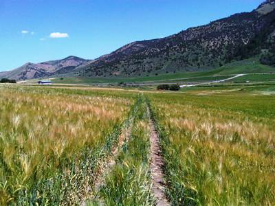
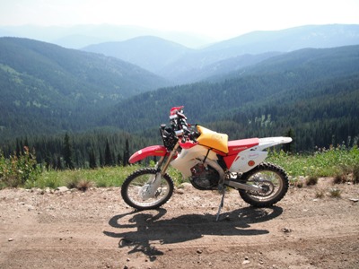
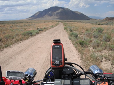 Approaching Big Southern Butte. Photo: Martin Hackworth |
|
Elk City has fallen on difficult times since the sawmill, a
center of the local economy, closed at the beginning of the recession.
Many businesses are boarded up and for sale. The Elk City Motel
is still hanging
in and I, again, found my key waiting in my room. Since the
Reno
Club is temporarily closed the only convenient WiFi in town is at the
Post Office so I hiked up the street in my MSR convertible riding pants
and Underarmor tee, an apparition to the locals, to email and
text
friends before going to bed. I got a reasonably early start the next morning for the long haul to Wallace (300+ miles). From Elk City one rides north 17 miles, turns right, rides another six miles and then cuts the motor for the seven mile, 3800' epic descent through the woods to Selway Falls - one of the highlights of the Tour. The road along the Selway River to Lowell has even less pavement than it used to and yields a very pleasant half hour ride along the river that's cool in contrast to the surrounding heat. Ninety minutes after leaving Elk City I was having a Rockstar at the gas station in Lowell. |
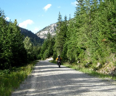
 Beverland Pass. Photo: Martin Hackworth |
|
I really wanted to ride the Pete King Trail again for several
reasons. The first is that it's a hoot, the second is that though it
doesn't cut any time off getting to the Lolo Motorway it does cut 25
miles - miles that come in mighty handy hours later when you are
coasting down hills trying to make it to Moon Pass and Wallace and
finally I
really hate the alternative (NFD 101). Unfortunately Pete King was
closed when I
got there (something I verified with a quick visit to a nearby ranger
station) so I had no choice but to head back to Lowell and pour as much
gas as I could into my Acerbis 4.75 gallon tank and my Liquid
Containment fuel
bladder (a total of about 7 gallons) and hope for the best. It's about
250 miles to Wallace from Lowell and without making the side trip to
Powell Ranger Station and there is no gas without scrounging. NFD 101 leaves US 12 at Syringa six miles west of Lowell. It is the most dangerous road along the entire Tour with numerous blind corners, slick gravel and lots of logging truck traffic. It is my least favorite segment of the entire Tour and the 20+ miles to Canyon Junction, which marks the beginning of the Lolo Motorway, can never come fast enough. |
 Switchback on Massacre Mountain Loop. Photo: Martin Hackworth |
|
The
Lolo Motorway up to Pete Forks was covered with pine and fig boughs and
riding it was surreal. At Indian Grave Peak where, 85 miles from
Lowell, I emptied the fuel bladder into the Acerbis tank and pondered
the odds of making it the remaining 165 miles into Wallace on 4.75
gallons of gas without a sidetrip down to Powell RS. I'd been getting
in excess of 35 miles to the gallon and the odds seemed good -
especially given the lateness of the day. Nonetheless I coasted down
the hill several miles to Cayuse Junction and NFD 581. NFD 581, the road that follows Toboggan Ridge from Cayuse Junction to Cayuse Creek, is one of my favorite sections of the Tour. The road is dirt but easy to ride and has one incredible scenic view right after another down into the Cayuse Creek watershed. The descent down Toboggan Creek into Cayuse Creek affords some of the best views along the entire Tour. Midway along the ridge, just before the beginning of the long descent down Toboggan Creek, I flushed a large, curious black bear out of the bushes beside |
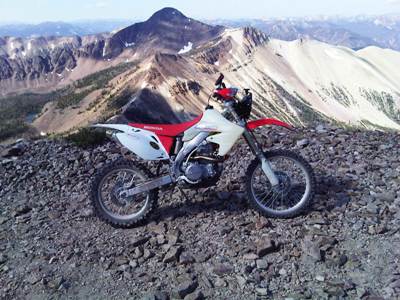
 Massacre Mountain and Castle Peak. Photo: Martin Hackworth |
| the
road. Rather than high
tail it off into
the boonies this bear adopted a gate to match the speed of the bike and
loped along the road with me for about a quarter of a mile or so while
we checked each other out. Forty miles north I managed to scrounge a little gas from a large, very friendly group of riders camped at Cedars campground on the North Fork of the Clearwater. With a full tank of gas and only 100 miles to go I knew that no matter what else happened I wouldn't run out of gas before Wallace. NFD 715, the road north from Fly Hill to Gospel Hill and on to the headwaters of the St. Joe River, was in the best shape I've encountered in about a decade. It's still a little rough on top but otherwise smooth enough for a Ford Focus across - which someone had parked in one of the campsites I passed along the way. The last three times I've ridden this stretch it'd been in either gathering or complete darkness so it was a treat to enjoy the tremendous panoramic views from the top of Pot Mountain Ridge in something besides moonlight. After 30 miles I encountered NFD 320 and the St. Joe River in actual daylight. |
 Twin Peaks Lookout. Photo: Martin Hackworth |
|
The miles along the St. Joe were scenic and more
pleasant
when encountered near the end of a 300 mile day rather than a 900 mile day.
Aside from minor adventures
with deer along the St. Joe River Road a few miles north of
Red
Ives it all went smooth and fast and though I blew past the turn for
NFD 1222 (the short way to the top of Gold Creek) I still found myself
at the intersection of Gold Creek Road and State Line Trail just as the
sun was going down. State Line Trail, NFD 391, is another of the more spectacular portions of the Tour and though the spectacular views were largely obscured by the gathering darkness I could still sense the voids off to the south while riding past Flattop, Craddock and Quarles Peaks. During the descent from the State Line Trail to Loop Creek I shot some night video and while setting up the camera noticed the none of my three GPS units were getting consistent fixes - which is the only excuse I have for turning south instead of north on Moon Pass Road and going six miles in the wrong direction before discovering my error. Without the extra gas I'd acquired a few hours earlier I'm pretty sure I'd have not made it to Wallace without pushing the bike over Moon Pass. The only comforting thought in this was that the CRF450X was bound to be easier to push over Moon Pass than either of it's predecessors had been. Since the Ryan is closed accomodos in Wallace were at the Stardust. The next morning I still couldn't get any of my GPS units to get a stable fix so map study and familiarity with the route paid off as I negotiated the maze of logging roads toward and across Moon Saddle some 30 miles north of Wallace. From Moon Saddle the Tour descends to the North Fork of the Coeur D'Alene River and follows County Road 1C west several miles to NFD 400. Up NFD 400 for a few miles and one proceeds west on NFD 409 across a series of saddles to Lieberg Creek where the road eventually rejoins the North Fork of the Coeur D'Alene River. |
 Pine Tree Boughs on the Lolo Motorway. Photo: Martin Hackworth |
|
Thirty miles north Bunco
Road descends toward Eight Mile Praire and US 95. This road,
freshly oiled, was possibly the slickest surface I've ever ridden a
dirt bike across (including a snow-covered Magruder Road one long ago
October). The low-side finally occurred a few miles short of Bunco
Corners and left me with a football-sized bruise on my right thigh that
quickly swelled to the point that I was unable to ride without
loosening my MSR riding pants. I stopped to rest in Athol and was
horrified when a glance in the bathroom mirror revealed swelling that
gave the appearance of something the size of a full Camelback
Bladder stuffed into one leg of my riding pants. A challenge that had cropped up was that the intake valves on the CRF had slowly tightened over the course of the trip to the point where the bike would no longer idle or start without a firm bump. I got it started at Athol by rolling through a borrow pit behind the gas station and headed north, post haste, to Hoodoo Mountain with a bona fide pain in my ass. Since I already had a room reserved in Priest River at the Eagle's Nest Motel I elected to stop there to try to do something about he swelling in my hip and finish the next morning. |
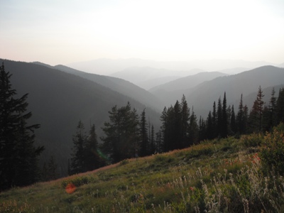
 Bald Mountain Creek, Lolo Motorway. Photo: Martin Hackworth |
|
A combination of ice and ibuprofen overnight got the swelling
down enough that I could get back into my MX pants the next morning. I
arranged to have my shuttle meet me at Lionhead Park on the shores of
Upper Priest Lake. The last miles up and around the lake were unusual
in that I had never seen Priest Lake in any condition other than late
afternoon gathering darkness. It's even prettier than I thought. I enjoyed this Tour as much, if not more, than I have enjoyed any of those preceding it. Riding at a slower pace (about 45 hours over 5 days) was much more mellow than the attention required by my usual race pace - and I got to ride everything. Riding alone meant that I could start and stop as I pleased and move at any pace I felt comfortable with. Being alone also provided more of a feel of total immersion in the adventure. I felt very small in an immense landscape. Now that it's done I feel less a sense of having beaten or conquered anything than having made some passage through a dimension that provided a glimpse here and there of things that you can see only with the right kind of eyes (Salude, HST). |
 The Selkirks, Upper Priest Lake. Photo: Martin Hackworth |
| Equipment: Ogio
Flight Vest (one 2-liter bladder
in each rear side pocket), Fly
Formula Scramble
Helmet, Moose Racing Sahara
ventilated jersey, Underarmor T-Shirt,
MSR over the boot convertible pants, Fly
Racing Moto Knees, Thor
Impact Rig, Scott
89Xi goggles,
Scott
clear goggles, Fieldsheer
Mach 6
gloves, Fly
Racing Enduro
Jacket, SIDI
Crossfire SRS Boots,
a small backpack, small tool kit, JB Weld, Fix-a-flat, MSR E-Bivy,
first aid kit with emergency
blanket, SPOT
Satellite
Messenger, two Garmin
Forerunner 201's, Fujifilm
Finepix XP10,
T-Mobile Blackberry
8900, Liquid
Containment fuel
bladder, MoJazz CRF450X
with Dunlop
GeoMax MX71 tires
(the shazz), Extra Strength 5-hour energy
(unbelievably effective). Video: Big Southern Butte: wmv, Massacre Mountain Loop: mp4, wmv, Twin Peaks LO: mp4, wmv, State Line Trail/Moon Pass Road: mp4, wmv Tour of Idaho Route Description Tour of Idaho 2008 My Tour of Idaho Manifesto Reader Forum |
 Quartz Creek from Fly Hill. Photo: Martin Hackworth |
| Home | Rides | Reviews | Bikes | Gallery | Tech | Misc | Contact |