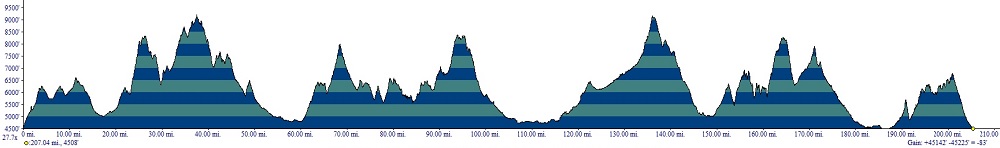
| The
Tour of Idaho (T1)
Beginning
in 2024, you are free to use the maps, waypoints and information here
any way that you please. I will keep the popular "challenge
point"
system that includes optional bonus and semi-optional challenge
sections, because riders liked it. But no more jersey numbers or
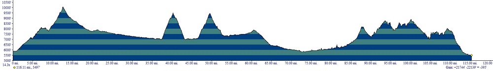
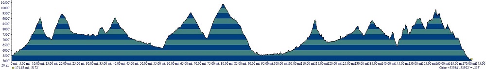
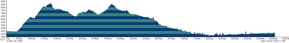
tracking. The Tour will involve 13 trail days and cover over
2000 miles
and 250,000' of elevation.
The Tour is rideable July through September.
The trails that
comprise the Tour are on public land (with a few
noted exceptions). There are no guides and
no
one makes any money off this other than those who sold you
what you need to ride a dirt bike in the wild and merchants along the
way. All that we do is plan, publish maps and a
route description,
and then go out and saw/maintain a lot of trail. You are welcome to the
fruits of our efforts.
Most days have an optional challenge section (these are not the same
as challenge points, which are not optional). Groups
must complete a
number of challenge sections equal to the number of riders in the group
(up to three - the largest group size allowed). Some of the challenge
sections are long, some are technically challenging, some are difficult
to navigate and some are all of the above.
Don't ride closed trails, have fun. Take some sense with you. Be careful out there.
Daily maps at 100K resolution: D1, D2, D3, D4, D5, D6, D7, D8, D9, D10, D11, D12, D13. The
color code is as follows: red = normal (two person) route,
green = solo route variation, blue = three member route,
yellow = challenge section, black = bonus section, purple =
circumstantial alternative (generally, in case of fire). If your browser cannot downlad these jpeg files, try Firefox.
Here is the special navigtion section on D2. Here are the mystery section written directions for D3, D4, D7 and D12. Here are the maps for D3, D4, D7 and D12. Finally, here are the Challenge
Points.
For
all GPS
units, here are the gpx files (note: different browsers handle the
.gpx extension differently. If the normal left click and save doesn't
work try right click and save. If that doesn't work use Firefox):
D1, D2, D3, D4, D5, D6, D7, D8, D9, D10, D11, D12 (n/a), D13.
If you have further questions please read this. files. The waypoints in the files are
descriptively named, e.g., 1D = day 1, 1C = day one challenge section,
x = one person route, y = two person route, z = 3 person route. Bonus or alternative
sections are denoted with small letters, e.g. "a." So
waypoint 3Dxy22 would be the twenty-second waypoint on day
three
on the
route
taken by one and two member teams. Waypoint 1Db3 would be the third
waypoint on the second bonus section of day 1. A bit of map
study
will clear up any confusion.
|
|
 |
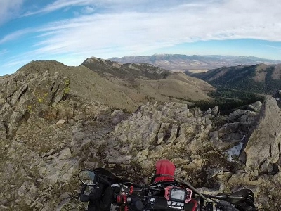
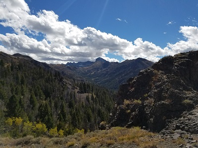
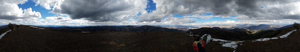
Moonrise
and Sunset at Chinese Peak
The longest distance
between fuel stops is about 250 miles, and you'll have to
manage
this twice - very workable on most
large
desert tanks along with a Giant
Loop
fuel bladder or two.
Finally, some miscellaneous helpful bits. We
have an extensive
collection of
Tour of
Idaho videos on our YouTube
page. The SNOTEL
page provides valuable
information about the nature of snow
levels on many passes along the Tour. The Idaho
Parks and
Recreation OHV
website
have interactive maps
with very high resolution views of
the trails for the entire Tour. These maps are an invaluable
resource for
road/trail numbers, opening and closing dates - there's even
an
Inciweb layer available. For fire information check out the Idaho
Inciweb page. The Idaho
Digital Atlas
contains a wealth of useful information about the Tour route. We also
highly recommend the Roadside
Geology of Idaho, an
indispensable pre-ride winter read.
A
trail is much more than a
line on
a map - it's the sum of of the efforts of all who worked to make it a
reality. We owe a great debt of gratitude to several individuals who
helped us wrestle this epic off of our laptops and into the great
outdoors.
| Tracy
J. Gravelle, the trails coordinator for the St. Joe Ranger
District of the Idaho Panhandle National Forest,
spent hours with us on
the phone and in exchanges of email planning the route through the St.
Joe. Stacy Baker and Dusty Baker of the Challis District provided much
useful
assistance.
The Challis district, btw, has the best trail crew in the state. |
|
 |
Members
of the Elk
City
Dust Devils ATV club are among
the most helpful and gracious
off-roaders it's been our pleasure to meet. They provided invaluable
assistance in helping us with the area from the Magruder Road to
Lowell.
Many
thanks to Donn
Dennis, Jim Spooner and Andrew Hixson, who provided information on northern Idaho.
Thanks
to our friends at Pocatello
Power
Sports for keeping us in bikes,
tires and accessories.
Note:
Nearly all
of the small towns along the Tour route have at least one establishment
with free WiFi. A WiFi enabled cell phone will generally be the only
inexpensive
way of checking in with family and friends at the end of each day and
uploading challenge point photographs. A really good reason for not
using one's cellphone as a primary GPS is that uploading Challenge
Point photos becomes problematic if one's phone
gets damaged or lost because it's exposed and vulnerable (it's happened
many times).
The following
description breaks the Tour into thirteen
segments. The
advantages of
the suggested schedule are that accommodations are not generally a
problem
and the riding difficulties
are distributed so that one day is not radically more
difficult
than the next. The intervals are as follows:
D1 - Malad to Pocatello, D2 - Pocatello to Arco, D3 - Arco to Leadore, D4 - Leadore to Mackay, D5 -
Mackay to Smoky Bar Store,
D6 -
Smoky Bar Store to Challis, D7 - Challis to Salmon, D8 (half day)
- Salmon
to North Fork, D9 - North
Fork to North Fork, D10 - North Fork to Elk City or Lowell, D11 -
Elk City or Lowell to Superior or St. Regis, MT. D12 -
Superior or St Regis to
Wallace, D13 - Wallace to Sundance Mountain.
The average Tour day is 200+ miles.
Please bear in mind that though we have covered every inch of the
recommended route and believe our descriptions to be accurate,
conditions can change, in some instances
very rapidly, due to weather, fire, human activities,
closures, etc. A group once got lost and abandoned the Tour
because of a new trailhead parking lot. It's very common for people to
miss trails or challenge points because they get tracks to follow from
sources other than here. But as thorough as we've tried to be, the
route description
and
GPS
files provided here are no substitute for the ability to pull out a map
and figure things out when you discover that you're not in Kansas any
more. Those attempting to substitute a GPS unit
for route finding and the ability to read a map will
doubtless
spend a lot of time lost. Again, navigation is a
deliberately important part of the adventure.
The Tour of Idaho is not a casual undertaking. Completing the
Tour requires reasonably high degrees of riding skill,
outdoor
acumen, physical conditioning, navigational ability, mechanical skill,
knowledge of emergency first aid and a healthy dollop of good
luck. The information on this website is not meant as
a substitute
for any of the above. A trail that
we describe as flat and fast, for instance, may change overnight as the
result of a
storm. You ride the Tour at your own risk. Any attempt to replace "eyes
on the spot" judgment with something you read here (or
elsewhere) may well result
in calamity. You may want to check out the FAQ
for answers to specific
questions we've gotten (or wish we had).
Please note that all estimates for time on the trail do not factor in
the additional time required for extensive sawing or completing the
more difficult
challenge sections.
In order to assist in
assessing what you are riding into from day to day, we have produced a series of trail ratings for the ATV and
single track trails on the Tour. Please
note that these are based on nominal conditions, and that all it takes
is one
storm to change things. All ratings assume an unaccompanied
rider with
no
support, on a loaded Tour bike, riding the trail for the first
time.
Remoteness, fatigue and technicality are all taken into account. The
scale is from 1 (easiest)
to 5 (most difficult) and the ratings are normalized to Tour of Idaho
trails.
So a rating of "5" does not mean the most difficult trail in the
Universe, just one of the most difficult along the Tour.
The technical ratings are augmented with a scale borrowed from
the
MPAA we've pressed into use here to indicate mental stressors such as
exposure, creek crossings and anything else that could ruin a Tour for
the unlucky or unwary. No suffix indicates a trail that should be no
problem for any competent solo rider of intermediate ability
on a
loaded Tour bike. A
suffix of "PG" indicates slightly elevated risk. A suffix of
"R"
means that one should make doubly sure that their beacon is
working. A suffix of "X" means to
radio the
tower and have them foam a runway.
Finally we have attempted to quantify the quality of each trail. This,
of course, is highly subjective and it is what it is. An asterisk (*)
indicates a
trail of above average quality. Two asterisks (**) indicates a trail of
that is virtually overflowing with redeeming social value. Three
asterisks indicates a veritable cornucopia of the most noble
characteristics to which any trail may aspire.
Malad City
The Malad City
Chamber of Commerce has arranged free parking in Malad, just a few
miles north of the Utah border, for Tour of Idaho riders. Here is a kmz file
that you may
open in Google Earth that shows where the parking is, and here is what
it looks like
from the street.
Just leave a note in the windshield of your rig that you are riding the
Tour of Idaho (it might not hurt to check in with the local police
either). The recommended accommodation in Malad City is the Hotel Malad,
which is
just a short jog from the parking area. Hess Lumber and Evans Co-op can
take care of your last minute hardware and sporting goods needs.
D1
- Utah
to Pocatello (190 - 220
miles)
| Jenkins
Hollow |
ST |
1 |
| Old Baldy Connector |
ATV |
3 |
| Old Baldy Connector * |
ATV/ST |
3 |
| Clifton Basin Loop |
ATV/ST |
2+ |
| Old Baldy-Weston Peak,
PG ** |
ST |
3- |
| Ruben Hollow |
ST |
1+ |
| Ruben Hollow to Davis
Basin |
ATV |
1 |
| Oxford Ridge, PG ** |
ATV/ST |
2+ |
| Cherry Creek/New Canyon |
ATV/ST |
1 |
| West Elkhorn/Kents
Canyon * |
ST |
3- |
| West Elkhorn
* |
ST |
1 |
| Monson Canyon |
ST |
2 |
| Farmer's Canyon |
ST |
2 |
| Elkhorn Loop |
ATV/ST |
2 |
| Fenceline Trail * |
ST/ATV |
3- |
| Wright Creek |
ATV |
1 |
| Aspen Hollow |
ATV
|
1 |
| Sedgwick Peak |
ATV |
2 |
| South Boundary Trail |
ATV |
2 |
| Robber's Roost (W to E), PG *
|
ST |
3+ |
| North Boundary Trail |
ATV |
2- |
| CS Boundary Trail |
ATV |
1 |
| CS Reed Canyon |
ST |
5- |
| CS Girl Scout Camp |
ST |
4 |
| CS Robber's Roost (E to
W), PG * |
ST |
4 |
| CS Boundary Trail |
ATV |
2- |
| Inman Pass |
ATV |
2 |
| South Fork Inman Creek
***
|
ST |
1+ |
| Blackrock Canyon
|
ATV |
2- |
| Chinese Peak * |
ATV |
1 |
Utah/Idaho
Border. Challenge point #1 |
Please
note: you must complete D1 before midnight on the day you set out or
it's a DNF.
This is
for your safety. If you get any reasonable start (before 5 a.m.) you
should be in Pocatello before dark. If not, the great wheel in
the sky is trying to tell you something - and you should listen.
Day
one
yields long, enjoyable
stretches of technical riding. There is more single track on
D1 than many dedicated dirt bikers encounter in an entire month of
normal riding. Roughly 2/3 of the
route consists of rugged single track, ATV or Jeep trail, with a
total elevation gain between 35,000 and 42,000
feet, depending
on the route taken. There are several impressively
long
and/or steep climbs. Navigation is challenging. Most competent riders
will take 13
hours or so to ride the solo route and 14+ hours for the two and
three-member team routes - without the challenge section or any bonus
sections.
Gas,
food and
water
are not a problem, with the longest distance between services being
about 70 miles. D1 is designed to give you a taste of what is to
come. If you cannot ride D1 in less than 17 hours in
reasonable conditions, or if you find the riding and/or navigation to
be overly difficult, you will find the days that follow to be desperate. |
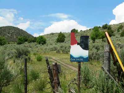
The Tour starts near I-15 Idaho exit #3
(Woodruff
Road).
This is a quick and easy ride from Malad. From Malad, take Old
Highway 191 south some 10 miles to Woodruff Road.
Turn left and head east over the freeway, then right (south) another
mile to the trail head at the mouth of Burnett Canyon. Head three miles
east up Burnett Canyon to a ridge.
Turn right (south) and head downhill
a mile or so to the Idaho-Utah border (pictured left). This is the
official start of the Tour. You should be there by 6 am, latest.
From
the border, head north six
miles along
a series of roads and ATV trails (70055 and 7488)
to
Dry
Creek Campground. Follow the dirt road east out of Dry Creek
(71224 then 70053) to ID
36, some 5 miles from the campground. Cross the highway and continue
about 1/2 of a mile to an intersection. Turn north (left) and
proceed a few miles along a
series of roads to
trail 7451. Take 7451 uphill. Note that your first opportunity for a bonus trail is
the Old Baldy Connector (7438), which leaves the main route at
waypoint 1Da0. Either way, you'll continue some 4
miles up to single track trail 7437. After this, proceed over Old Baldy
(8356') and on to Weston Peak (8165').
On the north side of Weston Peak, locate the intersection with
trails 7443
and 7444. Trail 7444 (North Weston Peak) is the first part of a bonus
loop. Others, head north on 7443 to Reuben Hollow. Take
trail 7441
east (right) a few miles to Buck Peak.
Here the trail turns north and descends about a mile into Davis
Basin. After Davis Basin the trail ascends the
steep
spine of Oxford
Ridge, gaining about 2000'.
After
a couple of miles of climbing leads to a knoll with a spectacular view. From here, Oxford Ridge levels off and heads
northwest toward
the summit of Oxford Peak.
|
Weston
Peak
|
Near waypoint 1DxyzOP1, there is a faint
singletrack
trail that heads off the west (left) side of the ridge, just before a
steep
climb to another knoll. Miss this and you'll regret it (especially on
the way back). Park at 1DxyzOP3 and hike a short distance to the summit
of Oxford Peak (1DxyzOP4). Do not ride your bike(s) along the final
footpath.
After the out and back to the summit of Oxford Peak, the Tour route
descends from Oxford ridge east near
Pine Corral
Spring along an
ATV trail (7419) steeply into Oxford Basin.
The descent from the ridge is not obvious and a look at
this video
may
prove useful.
After a long
descent to a small lake, the
trail climbs out of Oxford basin and rises along a series of short climbs spread over a
few miles, leading
to a
dirt road that goes east (right). Go left after 1/4
of a
mile and
head steeply uphill to a series
of ATV trails (7419) a few miles to Cherry
Creek.
At waypoint 1Dxyz29, head west
(left) down Cherry Creek Trail
(406) to New Canyon (420). A series of dirt and paved roads
leads
south then west, crossing I-15, to waypoint 1Dxyz39 and the West
Elkhorn Foothills/Kent's
Canyon Trail (329, 334).
Soloists will ride the entire West Elkhorn Foothills singletrack trail
(329) to Farmer's Canyon, with an optional (Monson Canyon) bonus
about halfway through
this section. At the northern end of 329,
you'll take West Wakely Peak (7391) up and over the Elkhorn Range
crest down to North Canyon, where you'll rejoin the nominal route at
1Dxyz42.
Two and three-member teams will turn north (right) after a few miles on
329 and head up Kent's Canyon (334), crossing the Elkhorn Crest near
Kent's Peak, and then down Mill Canyon to an intersection with
Powerhouse Road.
At this intersection two-member teams head east (right) down
Powerhouse Road to the 330 trailhead, Summit parking area, and then north on
trail 330 to the intersection with 331.
Three-member teams head west (left) back up
over the Elkhorn Crest, around the west side of the range, back up
to the Elkhorn Crest near Walkey Peak, then south and east back to
where the three variants merge again at waypoint 1Dxyz43 (333, 336,
330).
|
Oxford
Ridge
|
From 1Dxyz43, where the routes merge, it's just a few miles along some
ATV trails (371, 325, 374)
to Fenceline Trail (384, 331). Fenceline will test
your navigational skills. It's incredibly easy to get led astray in the
maze of criss-crossing game trails.
After Fenceline Trail, the solo route follows FS044 east to Marsh Valley road, then south and east along a series of farm
roads toward Downey. There is a truck stop where the road crosses over I-15, just before Downey.
Two and three-member teams will turn left (west) from the end of
Fenceline and take a series of jeep trails south toward Farmers Canyon.
The Wakely Peak trail loops back over the Elkhorn crest and down to the
Summit Guard Station at the east end of Mill Canyon. From there follow
farm roads to 1Dxyz71, where all routes converge.
From 1Dxyz71, take Back
Downata Road a few miles past Downata
Hot Springs to US 91. Though it
shouldn't be an
issue at this point, gas is available a few miles north on Highway 91
in Downey or south at Swan Lake. Downata Hot Springs is a nice
place to stop for a few minutes to cool off with a drink and a snack.
After
crossing US 91, the Tour jogs south about a mile to Calvin Road
(Red Rocks Back) on
the east (left), then east along Pratt Road to Cottonwood
Valley.
The route then follows a
series of logging roads and ATV trails (video)
that ascend to
the
summit of
Sedgwick Peak (9167').
A series of roads follows the crest of
the
Portneuf Range northwest from Sedgwick Peak some 10 miles, eventually
descending to Lava Hot Springs.
Fenceline Trail
|
Lava Hot Springs is a
resort community that is a fine place to stop for food and gas
before the afternoon/evening trek to Pocatello. We
recommend Sunnyside
Store/Sinclair station, on the way out of town, for a quick lunch
and fuel stop.
About a
mile west of Lava on
US 30,
turn north (right) on Sunnyside Road (70030).
Head
north 3 miles up Beach
Hollow (watch for a jog to the right near a house and a "dead end road"
sign) to an intersection with the Boundary Trail (7272). Here, the
regular Tour route continues west and north along
the
Boundary Trail some six
miles to Robbers Roost Trail (7253). Robbers
Roost climbs steeply up the west side of the range (video)
eventually crossing the Portneuf crest just north of
Haystack Mountain (9033'). There is then an equally steep descent
several miles to Big
Springs Campground back on the eastern side of the range. From
Big Springs follow the Boundary trail north about
4 miles again to the
Portneuf Range crest this time at Inkom Pass (7232').
The D1
challenge section
follows the
Boundary Trail
(7272) east and north from Beach Hollow for
several miles to Reed Canyon (7277), then up Reed to Girl Scout Camp
Trail (7274, road 70022), back to the Boundary Trail a few
miles south of Big Springs Campground. The challenge
section then
takes Robbers Roost
Trail (7253) from east to west (reverse of the regular route) to the
Boundary Trail and follows the Boundary trail north a few
miles to
Inkom Pass. It's permissible to
bail at the top of Reed Canyon and ride
down Bob Smith Canyon to reconnect with the regular route if you
conclude that you've bitten off more than you can chew. Why you should ride this.
Because it's there. Why
you should not. It's
long and difficult right out of the chute and has ended many
aspiring rider's
hopes of completing the Tour less than a hundred miles in. D1 is
already a long, long day. There's a
lot more ahead.
From
Inkom Pass, follow trail (7243) uphill and
north, then downhill and east to the South Fork of Inman Creek
(video)
trail.
Follow the South
Fork Inman Creek single track (7240), one of the most
enjoyable trails of the
Tour, north several miles to
Inman
Canyon Road. At the intersection with Inman Canyon Road head west
(left) and descend several miles to an
intersection with Rapid Creek Road. |
Inkom Pass |
From the
intersection of
Inman Canyon and Rapid Creek, travel west into the small town of Inkom.
Inkom is a good place for gas and a cool drink, if you choose, before
the
last sprint to Pocatello.
From
Inkom, head west about five miles along US 30 (all pavement) to
Blackrock Canyon
Road. Turn right and proceed under the freeway and north into Blackrock
Canyon. One, two and three-member teams have their own routes to the
top of Blackrock Canyon, where the routes all merge near 1Dxyz120. From
there, it's a final few miles of surprisingly fun ATV trails to the
summit of Chinese Peak. The views are grand, especially around
the
time of day you'll be
getting there (if you got a good early start).
From the
summit of Chinese
Peak the town of
Pocatello lies in the
valley to the west. Follow the wide, well-traveled
gravel
road that descends toward town. |
About three miles from the
summit
of Chinese Peak, you'll
encounter the TID flagpole on the left, about 100 yards
from the BLM parking area at the top of Barton Road.
This
is the last challenge point of D1. The
flagpole is on private property. You are welcome to sign the register
but please do not enter the property beyond the flagpole without prior
arrangement. The signs warning of an electric fence should be taken
seriously. You should also know that the llamas spit, the dogs
bite and the folks who live there are known to be armed, crazy and dangerous.
Pocatello is the largest town
along the Tour route. It's a full-service
University community of over 50,000 with numerous motels, hotels,
restaurants and
shops of all kinds. We do not recommend any particular motel or hotel
because all of the ones above "no tell" status are just
fine.
Pocatello has a
tremendous motorcycle
shop, Pocatello
Power Sports (Honda/KTM/Suzuki). The foks at PPS
understand what
the Tour is about, all you have to do is call ahead and they can
have anything that you need ready. They are great at
getting you in and out fast should you encounter bike difficulties on D1. Make sure that you
treat them well.
There are other shops in town catering to dirt bike needs as
well. The best of these is Syndicate
Development,
where Doug Haskett, AMA Team mechanic and genuine motorcycle
rain
man, can hook you up. Appointment in advance is highly advised.
While in Pocatello, we
recommend The
Sand Trap, Mama Inez or
the Sandpiper for dinner. Best bets for provisions are Fred Meyer for food and
general supplies. There are a variety of hardware and farm supply
stores in Pocatello that have basically everything.
Ethanol-free
gas is
available at Oak
Street Sinclair (premium
Ethanol-free is available at any local
Sinclair). |
|
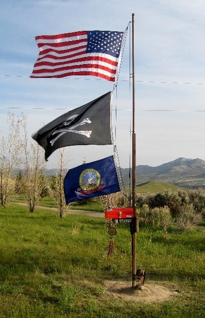 Tour of
Idaho Flagpole/Register Tour of
Idaho Flagpole/Register |
D2 -
Pocatello to Arco (220 - 250
miles)
| Slate Mountain, PG *** |
ST |
2 |
| Lead Draw |
ST |
1 |
| Crestline Cycle
Trail/Scout Mountain, PG * |
ST |
2 |
| Bell Marsh |
ST |
2 |
| Bell Marsh to Lead Draw |
ATV/ST |
2 |
| Valve House/East Fork |
ATV
|
1 |
| Racetrack Trail |
ST |
2- |
| Transmission Line |
ATV |
1 |
| Corral Creek
|
ATV |
2 |
| Elk Meadows |
ATV |
2 |
| Pole Canyon PG |
ATV |
1 |
| Wildhorse/Kinport |
ATV |
1 |
| Desert Trails |
ST/ATV |
2+ |
Day
two contains
some of the
world's mellowest motorcycle single track trail. It's an enjoyble
morning on mountain trails followed by some desert sand and lava rock
later in the day. The total
distance from Pocatello to Arco is between 220 and 250 miles, depending upon the
length of the special navigational challenge that you draw.
Begin by heading west out of
Pocatello to Gibson Jack Road (70008) and follow it to its end. At the
west end of the parking
lot find the ATV trail that crosses a creek and heads uphill
(7015) for less than half a mile to an intersection. Go left (downhill)
a short distance
to trail
(7018) which narrows to single track and heads southwest up Dry
Creek. Follow this trail some 6 miles as it contours the
eastern slopes of Gibson and Slate Mountains (video).
Aside from some brief side hill moments of concern this trail
is
one of the best anywhere.
Slate
Mountain Trail
You'll
eventually descend to
Mink Creek Road. Turn left there and
proceed northeast for about a mile to a
well-marked intersection with East Fork (Scout Mountain) road
on the right. Follow this east for a few miles to a road on the left,
just before a switchback. Follow this road a short distance to a
picnic area/campground.
Proceed south through the picnic area to the Crestline Cycle Trail
(7148). The Crestline Cycle Trail winds up wooded slopes to eventually
emerge beneath the rugged and spectacular east face of Scout Mountain (video).
After about 4 miles from it's start the Crestline Cycle
Trail intersects road 70009. From here one turns right (west)
and
follows the winding road 2 miles to the top of Scout
Mountain (8700'). Your first CP of the day is on top.
After the summit of Scout Mountain, reverse your tracks back to the intersection of Crestline Cycle
Trail with road 70009. Look for trail 7178 (Bell Marsh) on the left (east). A
20-mile
loop heads east
down Bell Marsh, then north as it circles back around to the west and
back into Lead Draw. It's a fun set of trails that are not
difficult.
Continue generally west along a set of ATV trails through a recreational area to Valve House Trail,
head south along Valve House to an intersection with East Fork Trail
(7186), then
north to an intersection with Race Track Trail (7184), a single track
trail that veers sharply to
the left (west). Follow this for about 3.5 miles west to South Fork
Road (70163). Race Track Trail is a local favorite. Watch for uphill MTB traffic. |
|
Slate
Mountain Trail
|
|
|
Crestline
Cycle Trail
|
Proceed
north along South Fork Road a few miles to an intersection
with Bannock Highway/Mink Creek Road. Turn right (north) and
proceed a short distance to Corral Creek Trail parking area on the
left.
Follow
Corral Creek (7061) a few
miles uphill to a dirt road (Clifton Creek - 70006). Head north along
this road a few miles to the Elk Meadows ATV trail (7022). Follow this
loop, clockwise, to trail 7029, Pole Canyon. Note - local mountain
bikers have cut numerous illegal trails in this area and many trail
signs
have been removed. If
you do get lost exiting the Elk Meadows loop, most trails on the
west
side of the loop will take you down to Midnight Creek (7058). You won't
be the first person to take an alternative route down to the creek.
Turn
right (north) at Midnight Creek and climb a few miles to the highlands
around Kinport Peak. Continue north a few miles along a series of ATV
and Jeep trails to Trail Creek Road. Turn left (west) on Trail Creek Road and proceed over Trail Creek pass, down to
Michaud Creek road. Take Michaud Creek Road north a few miles to East County Road, a
low-traffic road which parallels interstate 86, west toward American
Falls.
Once in American Falls, find your way to the Bingham Co-op (waypoint in the parking lot),
the best place for fuel and supplies in AF. The sandwiches there are
awesome. |
The
route out of American
Falls
proceeds west along ID 39 across the
American Falls Dam. Just across the dam turn left (west) onto Lamb
Weston Road. Jog around a few corners and turn south (left) on Borah
Road a short distance later. Follow Borah Road south and west about a
mile to a railroad crossing. From here follow Lake Channel Road 4 miles
southwest and begin looking for a sandy bowl
on the right.
The normally fine,
extremely dry basaltic
sand in this area is the most difficult that some have ever ridden.
Where the trails are
whooped it's difficult to keep up the speeds required to stay on
top of the sand. It is incredibly
important that you scout the rock chute entrance to Lake
Channel, to make sure that you are in the right spot, before
taking the plunge - as the
surrounding cliffs reach heights of nearly 100'. Most
attempts to do this after dark count as failed suicides rather than
heroic
deeds.
Please
note that it can be very
hot in the desert most afternoons during Tour season. Do not go out into the desert
without proper hydration and ventilation. On a hot afternoon, the 150 or
so mile ride from American Falls to Arco can be very serious
(110+ temps).
Once you get out of the sand and into the basalt rock (after the first
30 miles) you'll be able to ride fast enough to cool down - except
for numerous gates that need to be opened and closed. The
only real respite
from
the heat will be the summit of Big Southern Butte many miles to the
north. Plan
accordingly.
To
enter
the sand, bear right
off Lake Channel Road onto a sandy road. Follow it about 1/4
of a mile to a wash that leads slightly downhill
to
the west. Follow this to a well-defined trail that leads north
down a
canyon. After another 1/4 of a mile this trail climbs the steep left
bank of the narrowing canyon then heads west along a fence line. Climb
a
sandy hill, head west a few yards, then head back downhill to a sand trail that goes west back to Lake Channel Road.
Follow Lake Channel road several miles west to Quigley Road. Take this
north just a bit, then west, and look for a large, sandy parking area on the left
(west). Proceed south
then west about 1/4 of a mile to a cliff above Lake Channel Bowl.
It is advised that you get off your bike and
scout the entrance to the bowl
to make sure that you have the right one (a minimally technical short
rock chute that's difficulty changes a bit with the amount of sand
blown into the bowl below). Be aware that the cliffs in this area rise
to about 100'
above the bowl in some places and that you would be unlikely to enjoy
the plummet should you choose your line poorly. There is a CP at the top of the rock chute entrance to the bowl. .
Once
in the
bowl, follow the waypoints a half a mile to a climb out of the bowl on
the
right. Proceed along through a
mixture of
dunes, rocky roads, sandy roads and sandy trail about 5 miles to an
intersection with a trail that heads north. Turn
right after a bit (east), and head back to Lake Channel Road. Once there turn left
(north),
cross the RR tracks, and immediately turn right, following Quigley road
as it parallels the RR tracks. After about a half mile the road takes a
sharp left and heads north from the RR tracks.
From here the
route skirts the east edge of the Wapi Lava Flow some 35 miles
to
the Great Rift - an area of lava tubes and deep chasms in the Basalt. Proceed
north along Quigley
Road some 10 miles north to North Pleasant Valley then along Roth,
Winters and Crystal Ice Cave Roads, to a sign that indicates
that
you are entering public land..
At this point, high tech navigation ends and you'll have to do it the
old fashioned way: with a map, a compass and a way of accurately
determining distance traveled.
The special navigation challenge begins at the parking area at the entrance to public land. The compass in your gps unit or cellphone will probably be adequate,
but an inexpensive handheld wll be much easier to use. I am doing
nothing to make your route difficult to find or overly tricky, but I am
going to make sure that you feel good about actual navigation by the
time you get to BSB. I think that once you get to BSB you'll actually
have enjoyed the experience. You must disable tracking on your PLB once you begin this section. You'll enable tracking once you reach the summit of Big Southern Butte.
I'll provide you
with a set of directions (compass bearings, distances and landmarks)
through the desert to Big Southern Butte (where waypoint navigation
commences once again) when you reach American Falls.. If you look at any reasonably high-resolution
map
of the area you will notice that there are literally hundreds (if not
thousands) of ways to cross that stretch of desert. Each team will have
a custom route; it's length and difficulty will be tailored to team
size. Soloists get the shortest and easiest routes.
The approximate
length of route you'll have to navigate without
waypoints should be somewhere in the 40 - 70 mile range. All of these
routes will put you out somewhere along BSB-Springfield Road.
| |
From
BSB-Springfield Road proceed west to Frenchman's
Cabin. The
6-mile trek to
the
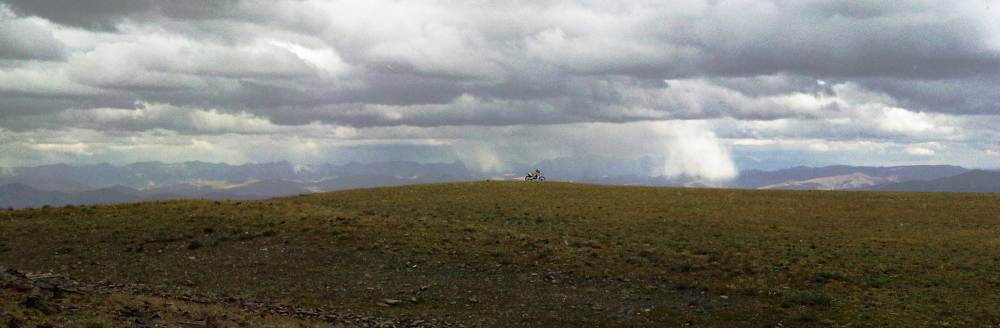
top of the Butte begins here. On a
clear day the view from the top (7560') includes a dozen mountain
ranges, 1/3 of the Tour, most of T2 and parts of Utah,
Wyoming,
Montana and Idaho's Snake River Valley from the Tetons all the
way
to Boise (video).
Your sixth and last D2 challenge point is on top
of the butte.
From
Frenchman's Cabin the Tour proceeds west along
Quaking
Aspen-Frenchman Road some 10 miles around the southern boundary of the
Idaho National Laboratory. Head west
toward Quaking Aspen Butte and an intersection with the Arco-Minidoka
road. Most of this section near the end of D2 is fast and flowing. Head north along the Arco-Minidoka
road 14 miles to an intersection with US
20/26/93. Turn north (right) and proceed about a mile into
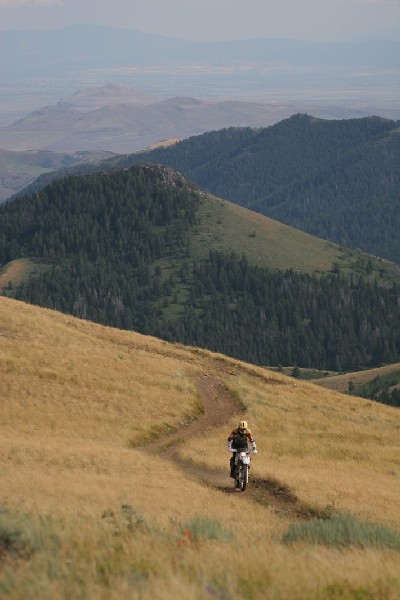
Arco. |
Big Southern Butte
|
Arco is
a small
community with an excellent motorcycle shop (Lost River
Honda), a variety of eateries and several motels.
It's a
dirt bike
friendly town, and anything short of wheelies down main street
will probably pass without notice. The folks at Lost River Honda have been especially helpful to
Tour riders over the years. Treat them well.
D3
- Arco
to Leadore
(270 miles)
| Sands Canyon Trail |
ATV |
2 |
| Mike's Trail |
ATV |
2 |
| Van Dorn Canyon |
ATV |
1+ |
| Blacktail/Mud Lake |
ATV |
2 |
| Hawley Mountain |
ATV |
1 |
| MT1 *** |
ST |
3+ |
| MT2 *** |
ST/ATV |
1 |
| MT3 *** |
ST |
2+ |
| MT4 *** |
ST |
3 |
| MT5 ** |
ST/ATV |
2 |
| CS ** |
ST |
5 |
Day
three is long and fraught with adventure. From Arco, your journey begins into the very heart of Idaho and
the best that the Tour has to offer. There's lots of single
track, and all of it will be worthy of your attention. Gas should not be an
issue (it's about 120 miles from Arco to Leadore). The first mystery section (navigation by trail name and directions) of the Tour begins north of Pass Creek Road. You'll
receive instructions for the mystery section, via email, before you leave Arco. The total
distance for D2 is around 250 miles. A challenge section is available in the mystery section. Like the West, itself, it's rough, but it's fair.
The
route out of Arco may be
found off
US 20/26 near the southeast edge of town. Look for the submarine parked on the east side
of the highway (I kid you not). Turn east
(left) at the sub onto HiWay Drive which parallels US 20/26 southeast
for a 0.3 miles to a fork in the road. Take the east (left) fork 1
mile to an intersection with Arco Pass Road on the north
(left). After about 7 miles the Arco
Pass Road
intersects Sheep Camp Road near the base of King Mountain. Head
east (right) then north along a series of jeep roads that
skirt
the eastern flanks of King Mountain, up and over Arco Pass,
down to Little Lost River Valley.
From here you'll head north about 10 miles to the entrance to Sands
Canyon ATV
Trail (4210). At this point, the route
divides briefly into x, y and z options.
Soloists
will head north along 12101 and 12111 several miles to Bird Canyon
(40214), then west (left) and uphill to Mike's Trail (4308). Follow
Mike's Trail north for a few miles to an intersection with
40431, Van Dorn Canyon Road.
Two and three person teams will
turn west (left) and proceed up Sand Canyon several miles to
a
divide
between Bird Canyon (west) and Van Dorn Canyon (east). From
the top of the divide, two member teams will head north on Sand Canyon
trail to Mike's Trail (4308) and an intersection with the solo
route. Three member teams will head west down Van Dorn Canyon (4217).
All three variants intersect at Van Dorn Canyon
Road.
Mystery Trail #1 |
Please
note that Sands and Van Dorn Canyon trails are seasonal and
close before the
Tour closes (before the middle of September). After these trails close, all teams will
follow the solo
route through this area. Two and three member teams will be required to
do a bonus loop to make up for the trails lost
due to closure.
Shortly after the routes merge turn north (left) at Van Dorn Cutoff
Trail (432) and after a brief jog north turn west (left) at
Deer
Creek Trail (277). After just a bit, turn right (north) and
proceed north to the Hawley Mountain ATV trail, then northwest to Pass
Creek Road.
From
Pass Creek Road, it's about 75 miles to Leadore. Once you hit single
track, I think
that you'll find it to be among the best you've ever ridden. It's never
incredibly difficult (except for about a mile) on a Tour bike, but it's
continuously entertaining. Most riders consider this to be the premier
section of the Tour. Just
don't get to it after dark. That would be very unfortunte. You must disable tracking on your PLB in this (and every other) mystery section.
|
D4 - Leadore to Mackay (200 - 240 miles)
| MT1 ** |
ATV/ST |
2 |
| MT2 *** |
ST |
2 |
| MT3 ** |
ST |
2 |
| MT4 (bonus 1) * |
ST |
4 |
| MT5 ** |
ST |
2 |
| MT6 * |
ATV |
2 |
| MT7 ** |
ST |
2 |
| MT8 *** |
ST |
3 |
| MT9 *** |
ST |
2 |
| CS, R ** |
ST |
4 |
| MT10 (bonus 2) *** |
ST |
3 |
| MT11 * |
ATV |
1 |
| MT12 * |
ATV |
1 |
| Blacktail/Mud Lake |
ATV |
2 |
| Bear-Wet Creek (bonus 3) * |
ST |
3 |
Day four may
be long or short - depending upon choice of route. The nominal route is
around 200 miles. There are three bonus sections and a challenge
section. The second bonus is long - about 40 miles. The CS is one of
the toughest. There is no gas available anywhere along the route, until
you get to Mackay.
Most of D4 is a mystery route. The last 40 miles of the day are not, and those are described below. You should enable tracking, once again, at waypoint 4Dxyz0.
From
4Dxyz0, a series of farm roads will lead you from the Little Lost River
Road to to Deer Creek Road (FS277). At 4Dxyz3, turn north (right) at
Van Dorn Cutoff
Trail (432) and after a brief jog turn west (left) at
Deer
Creek Trail (277). Head generally west, along
FS277 and then FS4094 to an 8000' pass between Basin Creek and Mud
Lake, then downhill several miles to an intersection with Pass
Creek Road
(122). This area is sometimes closed until late in the season due to a
huge, active avalanche chute (you'll see it) and an alternative route
is available if a detour is necessary.
At Pass Creek Road, a third bonus trail is available. To reach it,
proceed north a few miles to Pass Creek Summit. From there
turn west (left) and head up FS539 a mile or so to an intersection
with trail 4092 on the south (left). This single track wanders around
Warren Mountain some four miles to road 832 which intersects Pass Creek
Road after a short distance.
Others head south down Pass Creek road a few miles to an intersection
with
Bench Road. Turn west (right) and proceed several
miles to the town of Mackay. Mackay has gas, grub and a
hardware
store. There are three motels: The Bear Bottom Inn, The Wagon Wheel and The White Knob. Arco isn't too far down the road if these places are full.
D5
- Mackay
to Smoky Bar
(115 miles)
| Stewart Canyon - Corral Creek |
ATV |
2 |
| Wildhorse Lookout, PG *** |
ATV |
2+ |
| Burnt Aspen-Kane Canyon
*** |
ST |
2- |
| Warfield-South Fork ** |
ST |
2 |
| CS Meadow Creek |
ATV |
1 |
| CS Placer Creek |
ST |
3 |
| CS East Fork Big Peak Creek |
ST |
4+ |
| Middle Fork South
Fork * |
ST
|
2 |
| Middle Fork Warm Springs ** |
ST |
2 |
| Dollarhide Summit * |
ST |
1 |
| Big Peak - Carrie Creek ** |
ST |
2 |
| Grindstone-BIg Peak ** |
ST |
2 |
| Lick Creek (West) |
ST |
2- |
| Lick Creek (East) |
ST |
3 |
| Lower East Fork Big Peak, PG |
ST |
4- |
| Big
Smoky Creek, PG |
ST |
3 |
| Lick Creek/Big Peak Creek
Connector |
ST |
2+ |
Burnt
Aspen/Kane Creek |
Day five begins your journey into the center of Idaho. There's lots of single
track.
Gas should not be an
issue. Most
will find this to be a relatively easy, albeit surprisingly longish, day. Unless you
do the challenge
section, bonus section or are in a team of three, you should be kicking
back at Smoky
Bar Store by later afternoon.
From
Mackay, you'll head out of town to the south via Smelter Ave, west
past Anderson Spring toward the entrance to Grande Canyon. At waypoint
5Dxyz2 turn to the south and up Alder Creek Road. About six miles
later, at waypoint 5Dxyz5, you'll intersect Mammoth Canyon Road (517)
and turn north (right). Head
up Mammoth Canyon about a mile to road 40516 on the west (left) which
quickly turns into trail 4070 in Stewart Canyon. Those who disdain quad
trails as
unworthy are in for a surprise. You'll crest 10,000' for the first time
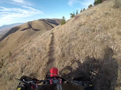
on the Tour here on the White Knob Mountain crest, at the pass between
Stewart Canyon and Corral Canyon.
After
the pass you'll descend north then west down Corral Creek a few miles
to Burma Road. Take Burma Road south to East Fork Road - the main drag
through Copper Basin. Head north then west several miles to trail 4056
that heads up Wildcat Canyon and Wildhorse Lookout (9359') - truly one
of the
more spectacular spots along the Tour. Again, for those who disdain all
quad trails as unworthy, here's another bit of trail to help with your
evolution. |
After
the descent from Wildhorse LO, turn west (right) and jog down East Fork
Road a short distance to Wildhorse Creek on the left. Head south along
Wildhorse Creek Road (40136), past the Guard Station to Burnt
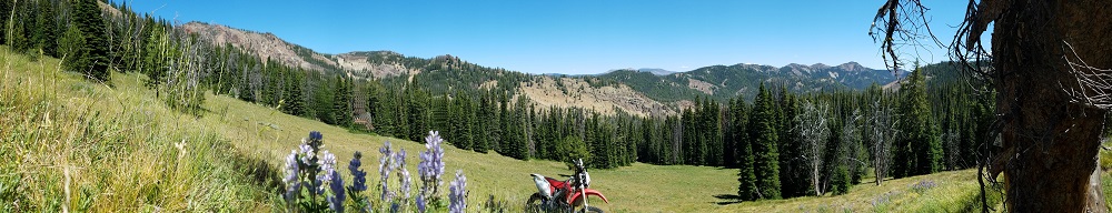
Aspen Trail (4055) on the west (left). This trail is among the best of
the entire Tour. You will enjoy the increasingly spectacular views as
you wind your way up to the divide between Burnt Aspen Creek and Little
Kane Creek - and they get even better as you wander down the
Kane
Creek
drainage.
At the bottom of Little Kane Creek you'll encounter a road (40134) that
winds its way west around Phi Kappa Mountain to Trail Creek Road (NFS
208). From
here the route heads
west over Trail
Creek Summit. From Trail Creek Summit you'll head southwest some 12
miles to
Ketchum/Sun Valley Idaho - a.k.a. "Glitter Gulch." Bruce Willis lives
here. So do Peter Cetera, Steve Miller, Arnold Schwarzenegger, Mark
Zuckerberg, Demi Moore, Ashton Kutcher and Tony
Robbins. Hemingway
had a
home here as well, and that might've had something to do with why he
volunteered
for an early ride on the great wheel in the sky, on July 2, 1961.
I suggest
taking the time to park your fanny on a bench in the
vicinity of
Whiskey
Jacques and just take it all in (you are, after all, on a Tour of
Idaho). The
immortal words of Sophocles, "Oh, God, here comes the dreadful truth,"
will never ring more true. More than a few hours here and you will want
to jab yourself in the knee with a piece of rebar.
Do not let the laid back demeanor of the locals wearing $300 sandals fool you either. Almost everyone
staring at
you and your bike dislikes you and hates your bike. Shall
I fan you gently so
you don't go into
shock?
Fortunately, there is a full-service motorcycle shop in the area. It's south a few miles, in Hailey. Karl Malone Powersports. Call in advance and these folks can usually get you in and out in short order.
The pass between Stewart
Canyon and Corral Creek. Photo was taken from the Challenge Point.
From
Ketchum head west along
Warm Springs Road (NFS 227) about 11
miles or so to Warfield-South Fork Trail (7151). Head southwest for a
few miles until the trail climbs steeply through a series of
switchbacks to an intersection with Red Warrior Trail (7120) on the
left. Continue south, then west, then north to Middle
Fork-South
Fork Trail (7199). Here, just beyond waypoint 5Dxyz33, a short cut is
available to soloists. All others will take Middle Fork Warm
Springs Trail (7150) to Dollarhide Summit
Trail
(7995), then a few miles west toward
Dollarhide Summit. The exit from the trail is a bit difficult
to find
but is very close to waypoint 5Dxyz35 off to the right in the middle of
a
steep uphill sectionl. Someone usually piles up some logs
here to block the trail, but you'll most likely wheelie over
them
as the trail appears to continue ahead. It does, but only for another
1/4 of a mile or so.
The
D5 challenge section begins near waypoint 5Dxyz33 and
continues along
trail 7151 (part of the solo route) to Meadow Creek ATV trail (7302)
back to Warm Springs Road.
A right
turn here leads you to the challenging part of the D3
challenge: Placer Creek/East Fork Big Peak
Creek (7076). Why you
should ride it. It's challenging and scenic. Why
you should not. It's
a long way to
the intersection with Lick Creek (7080) and you'll need your
big-person
jammies some of the way. In nominal conditions it's an
adventure. Besidesa, getting to visit Smoky Bar Store is a Tour
highlight. Why arrive later than you need to? Please note that the
first part of this closes very early
each year (end of August).
From
Dollarhide Summit proceed
west another 5 miles to an intersection
with Trail 7016 (Big Peak) on the right. Follow this trail
uphill a few miles to an intersection with trail 7081
(video).
Follow
this about 5 miles west to an intersection with Lick Creek Trail
(7080). One and two
member teams:
continue straight on 7080 west 4 miles to an intersection with NFD
227 and Big Smokey Guard Station just a stone's throw down the
road. Three member teams:
Turn back right (east) on 7080, Lick Creek Trail, and follow it a few
miles downhill to an
intersection with East Fork Big Peak Creek (7076). Turn left (north)
and
head a few miles to an intersection with Big Smoky (7072). Beware of
numerous creek crossings on Big Smoky Trail. More than one person has take an
unplanned bath here. You might need to read this.
Your day ends at Smoky Bar Store. You must make reservations in advance
if you expect to have a bunk for the night. Please make sure to tell
Kaylin, your host, that you are on the Tour of Idaho T1. She'll do her
best to hook you up. Please note that the Smoky Bar Store does not have
gas pumps but you should ask about options upon booking. Smoky
Bar Store Facebook, 208-539-7849. |
 Warfield -
South Fork Trail - the "Cliff View" challenge point Warfield -
South Fork Trail - the "Cliff View" challenge point |
D6
- Smoky Bar
to Challis
(170 - 185 miles)
| Paradise Creek (to Snowslide) ** |
ST |
3 |
| Paradise Creek (after
Snowslide), R ** |
ST |
3 |
| West Fork Big Smoky |
ST |
2 |
| Mule Creek ** |
ST |
1+ |
| Chemeketan |
ST |
1 |
| Grand Prize Gulch * |
ST |
2+ |
| Bowery * |
ST |
3 |
| Little Boulder Creek, PG
*** |
ST |
3 |
| Frog Lake, PG |
ST |
3 |
| Big Boulder Creek ** |
ST |
2 |
| French Creek |
ST |
3 |
| Thompson Creek/Cinnabar |
ST |
3 |
| Fivemile Creek, PG |
ST
|
3 |
| CS Custer Lookout?Ramey Creek,
X *** |
ST |
5 |
| Elevenmile Creek, PG |
ST |
3 |
| East Mayfield/Yankee Fork * |
ST |
1+ |
| Squaw Creek |
ST |
2 |
| Squaw Creek
|
ATV |
1 |
| Buster Lake |
ST |
2+ |
| Beef Pasture |
ATV |
1 |
| Trealor Creek |
ATV |
3- |
| Kinnikinic Creek
|
ATV |
2 |
| Happy Hollow/Juliette Creek |
ST |
3 |
| Ramshorn/Keystone
Mountain *** |
UTV |
2 |
| Lombard Trail ** |
UTV |
2- |
Day six again
traverses some of the most spectacular terrain accessible by
motorcycle, anywhere. It's 170+ miles of continuous fun with an
elevated level of
challenge - in terms of both riding and navigation. Fuel
should not be an issue with Smiley Creek and Sawmill Station
strategically located along the route. Somewhere north of 10 hours
ought to suffice for soloists. A few hours more for teams. It's a longer day than you'd think just based on the mileage.
From the
southern end of Big
Smoky head north
about 11 miles
along Paradise Creek Trail (7070) to Snowslide Lakes.
The first part of this is fast and flowing with just a bit of gnarl
before
Snowslide Lakes. After the pass at Paradise Peak
you'll encounter
what many will consider an introduction to "side hills of
major concern" - a theme that will become much more prevalent in coming
days. One of the reasons for starting D4 at Smoky Bar in 2020 was to
give more teams an opportunity to see how far down it is off the side
of the trail, in a couple of spots, in broad daylight. The good news is
that it's only two switchbacks.
After the second switchback head down mile or so to the West Fork of
Big Smoky (224), then southeast just
a
bit over two miles and look for an intersection on the
left with Mule Creek Trail (198) which is not well-marked. Trail 198
is a riot (video),
and
will aptly punctuate a great morning of riding as you follow
it
up several miles to the divide between the Smoky Mountains and the
Sawtooths and an intersection with Big Smoky Creek Trail (072).
From
this intersection head north and follow the trail steeply
downhill
a few miles to an
intersection with NFD 215. The small creek on your left is the origin
of the mighty Salmon River. About 5 miles later you'll encounter ID 75.
From here it's a short jaunt north to Smiley Creek Lodge where gas is
available if needed.
From
Smiley Creek there are a variety of ways east to Grand Prize
Gulch. The Corrals ATV trail (7259) is the best. If you detour
north to Smiley Creek it is not necessary to ride all the way
back
down the highway to rejoin the route at the base of Galena Pass.
Instead feel free to head east on Valley Road to Pole Creek
Cutoff
and hit Corrals Trail there. It's
about 4 miles further to a intersection with Grand Prize Gulch Trail
(7112).
Follow 7112 uphill a few miles to the scenic
view at
the top of the pass. Continue downhill about 5 miles to the
East
Fork
of the Salmon
then another few miles further to NFD 120 near the Bowery Guard
Station.
Note that an alternative trail, Bowery (7114), is available in this
area. Since the main trail is currently closed in an easement dispute
with a landowner, you'll have to take the alternative from the guard
station, up and over Bowery. Turn right at 6Da5 and follow
Germania Creek to East Fork
Road to reconnect with the regular route.
From
the Guard Station, follow the East Fork Road about 8 miles to an
intersection with the Little Boulder Creek Trail (7682) on the left. This
single track is
one of the
highlights of the Tour (video).
Follow LBC
(7682) about 4 miles to a clearing with a spectacular view of Castle
and Merriman Peaks, then another 6 miles (7407) up and over a pass and down to
the mining town of Livingston
(video).
|
|
Little
Boulder Creek. The view from the Challenge Point.
|
The
next 5 miles (70669) climb
steeply
to the highest point of the Tour (10,420') atop
Railroad Ridge where you'll want to pause to enjoy a vista
that includes virtually all of the highest parts of Idaho and the
spectacular Chinese Wall.
Proceed
north 11 miles (70670, 7615, 7675,
2001) to French Creek where
the trail narrows from dirt
road, to jeep trail to
single track as
it descends down to the
Salmon River. At the very bottom
of
French Creek, within sight of Hwy 75, the trail bears left to avoid
private land near waypoint 6Dxyz43. Do not go through the gate to get
to
the road. Instead find the
trail off to the left which climbs a side hill and descends toward a
trailhead parking area. From
the
intersection with
Hwy 75 head east
about a mile to Old
Sawmill Station
where gas
is available (24 x 7) along with supplies
and some great sandwiches.
Railroad
Ridge - the roof of the Tour. The motorcycle is on the Challenge Point.
From
Old Sawmill
Station,
head west along 75 about 3 miles to a bridge which crosses the
Salmon
River on the right, The right of way on the north side of the bridge is
private so head west another two and
a half
miles along 75 to a dirt road just the other side of a bridge that is
a public right of way. Follow this back around to Thompson
Creek
Road (FS 040).
Head
north along Thompson Creek Road (FS 040) about 10 miles
to a trail on the left (161) near waypoint 6Dxyz51. This trail is not hard
to miss, but you'll know you did if your start climbing steeply up a
series of switchbacks. Follow
161 west about a mile and a half
to Cinnabar Creek Trail (162). The last 1/4 of a mile up to Cinnabar
ascends a steep meadow and the trail is a bit difficult to follow. The
optimal path is marked by a series of rock cairns. Turn left (west) and
follow the trail about a half mile to an intersection at a pass.
A
very short distance to the west along trail 162 you'll
encounter the D6
challenge section:
Custer LO. This is a spectacular trail, and a must do at some point in
your riding career, but one of the more airy and technical
challenge sections on the Tour. Though short
this eight mile CS will test your meddle - including
your ability to deal with dizzying side hills. You must go all the way to the
lookout, which requires some extra work, to complete the
challenge section.
Why you
should ride it.
You'll never
find a better view than from the
top. It's one of my favorite
places. Why
you
should not. It's a long way
down in a few spots and some
commitment is required to advance. Not advised for soloists. The ride out Ramey Creek is no joke either.
Continue
west down Fivemile Creek to an
intersection with Yankee Fork Road (FS 070). Turn right and head
northeast about six miles to Elevenmile Creek.
Thompson
Creek
|
|
Three
member teams will turn right (west) and follow Elevenmile-Martin
Creek (4148) and Mckay-Elevenmile to Squaw Creek. It's a bit of a steep
climb up to the divide but three-member teams have plenty of hands to
help each other near the top.
All others will
continue another few miles along 070 to McKay Creek on the
south (right). Just before the McKay Creek trailhead you'll encounter
the East Mayfield/Yankee Fork trailhead on the north (left) side of the
road. This bonus trail is an out and back to the Wilderness area
border. It's fairly pleasant, very easy and not a long detour for those
so inclined.
From the McKay Creek parking area follow a well-developed track about a
mile as it turns into trail 151. Continue a short
distance
south to an intersection with Squaw Creek Trail (149) where the
three-person variation rejoins the main route.
About three miles south along Squaw Creek, at Willow Patch meadow, the two and three member
team routes divide again. One and two member teams will turn east (left), on Aspen Creek Tail (4152). Take trail 4152 east toward Buster Lake, then 4201
south toward Trealor Creek. Three member teams continue south to FS
40041 (Squaw Creek Road). Then back north, near 6Dz5, up 40045 (Trealor Creek Road), toward Trealor Creek Trail
(4159).
|
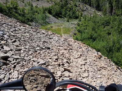
The area near the Trealor Creek Trail trailhead is where all
variations converge. Trealor Creek Trail
is one of the worst beater ATV
trails that bad dreams are capable of conjuring - though it does get better
with
elevation. Soloists follow this five miles up and over Buffalo Ridge
and
down to Bayhorse Lake, then down Bayhorse Creek Road about a mile to an
intersection with a jeep road that ascends sharply to the
left.
Two and three person teams take a slightly longer loop to the south around Spring Basin, Cabin Creek and Juliette Basin.
|
Thompson/Cinnabar
Challenge Point. |
|
From 6Dxyz62, where routes converge, head
up the road past Little Bayhorse Lake to a hard left at waypoint 6Dxyz65
and past a spectacular rockslide. Continue east
a few miles
to the summit of Ramshorn Mountain and east a few more miles
over Keystone
Mountain
to an intersection with the Keystone Gulch jeep road.
From
here,
ascend Keystone Gulch and hang a left, near waypoint 6Dxyz72, onto the
Lombard ATV trail
(4639). Continue
northeast past Blue Mountain (video).
Just a
few miles outside
of Challis, a mile
or so below the pass north of Blue Mountain, the trail splits,
near waypoint 6Dxyz77. The
right fork descends to the State Park at Yankee Fork (a fee area). Take
the left fork, right down the creek bed, a few miles into
Challis.
Challis (5000'),
at about trail
mile 700, is about
the same size as
Arco (population
1200) and
has about the
same level of services. There
are several motels,
half a dozen or so
eateries and plenty of choices for gas and supplies (The
Village Square on U.S. 93, is particularly well-equipped for
your TID needs:
straps, gas jugs, tools, outdoor equipment - we even found 2 and 4
stroke
motorcycle oil there). Ethanol-free gas is available at Kimble
Oil and
Brett's
Automotive.
The Challis
Village Inn is
our favorite place to
stay in Challis but there are several other perfectly fine motels. Any
of them will work.
You should know that the owners of the craft brewery in Challis have
expressed unfriendly views concerning motorized recreation in public
meetings. PBR is better for you anyway - and it mixes great with
Pedialyte.
If
time
permits the Yankee Fork Interpretive Center (south of town at the
intersection of US 93 and ID 75) is well worth taking the time to
visit.
Please note
that accommodations in Challis are generally unavailable during the Braun Brothers
Reunion which will be held August 10 - 12 in 2023.
|
|
 |
| Ramshorn
|
D7
- Challis
to Salmon
(195 - 225 miles)
| Pat's Creek,
PG * |
ST |
3 |
| Eddy Basin |
ST |
2 |
| Darling-Castle Creek, PG ** |
ST |
2+ |
| Little West Fork * |
ST |
2 |
| West Fork Morgan
Creek, R * |
ST |
3 |
| West Forks Lakes
Cutoff ** |
ST |
3+ |
| Darling-Castle Creek, PG *** |
ST |
2+ |
| Alder Creek, PG *** |
ST |
2+ |
| Corral Creek |
ST |
2+ |
| Corral Creek Spur |
ST |
1 |
| Big Hat Creek |
ATV |
1 |
| Ward Butte |
ST |
1+ |
| Hat Creek Lakes, PG * |
ST |
3+ |
| Big Hat Creek *** |
ST |
3+ |
| North Fork Hat Creek |
ST |
2 |
| MT1 ** |
ST |
2+ |
| MT2 ** |
ST |
2 |
| CS ** |
ST |
3+ |
| MT3 ** |
ST |
2+ |
Day seven includes the second
highest point of
the Tour (Twin Peaks
Lookout -
10,330') and about 70 miles of single track that is
both very remote and continuously entertaining.
Most will find
this to be a relatively long day for the distance (a bit less than 200 miles). Twelve
hours ought to suffice if
the trail is clear (later in
the season). Some of the
trails on D7 are
rarely ridden outside of the Tour of Idaho community. At the
beginning of the season it could take two days to ride this
section if it hasn't been sawed. There is no gas available between
Challis and Salmon. In terms of difficulty, D7 is above average just
because there is so much ST that will demand attention..
To
begin, head west
up Main Street a
few blocks to 7th Street/Challis Creek Road
on the north (right). Proceed north out of town five
or so
miles to an intersection with NP644 (Darling
Creek Road) on the right. From this intersectiom it
is about 12 miles along Challis
Creek, Sleeping Deer and Twin Peaks Jeep roads to the summit
of Twin
Peaks
Lookout (video). Enjoy
the view. Be sure to visit with the person in the lookout (unless you
are there before dawn). They know about the Tour and generally have
great stories to tell.
On
the descent from Twin Peaks head back down to Challis Creek Road
and look for Pats Creek (40173) on the left
side of the
road
near the
intersection of Challis Creek and Valley Creek, not far from the houses
you first pass on the way down.
Turn
left (north) and
follow the Eddy Creek/Camas Trail (4134) a few miles to Eddy Basin.
Turn right on trail 4145 and head uphill a few miles to a
sharp right turn (at 5Dxyz19)
that's easy to miss. Head southeast
as the trail climbs to a spectacular view of Eddy Basin. Continue to an
intersection with Trail 4144 which
descends to a picnic area at the top of road 176.
Follow this road
downhill a few miles to an intersection with road 057 and turn left.
Follow 057 northwest about 3/4 of a mile to the West Fork of Morgan
Creek Trail (4143).
|
|
Twin
Peaks.
|
Furnace Creek
Challenge Point
|
Once you head up West Fork trail
you are
entering one
of the most
remote single track areas you'll visit on a motorcycle in the
United States. Trail 4143 has wonderful
views and is of only moderate difficulty (except for
a few short technical
sections), but it is smack dab in the middle of nowhere. Don't ride off
a side hill or
break down. It's a long walk out, and most days no one is
coming up the
trail except another Tour of Idaho rider.
Follow
Trail 4143 up
Morgan Creek for about 3 miles to an
intersection with trail 4234. Continue another few miles past West
Fork Lakes - climbing steeply to the scenic headlands above Morgan
Creek/Furnace Creek and an intersection with Trail 4138
which loops back to the
east. The next few miles are outrageously fun. A few years ago
I
rode through a herd of at least 50 elk here.
As 4138 descends from the ridge top it
intersects Lick Creek Trail (4142) on the right. Continue northwest (left)
on 4138 from
this intersection and around the steep slopes above
the
headwaters of Furnace Creek. After another 1.5 miles you'll encounter
the actual Furnace Creek on the right (west).
|
Turn
right and continue northeast up Furnace Creek over a divide
west of Van Horn Peak (9616') and an intersection with Trail 4139 which
descends to the right. Then continue on Trail 4138 a mile or so
to the challenge
point a pictured below.
It's a really good idea to locate
this challenge point then get off
your bike and then look around. The trail ahead may not go where you
think that it should and more than one person has nearly ridden off a
cliff here. Go west, young man.
Descend to the western flanks of
Wood's Peak and contour around a few miles to an intersection with
Trail 4135 (Black-Alder Creek).
After that it's a very pleasant cruise down Alder Creek to Morgan Creek
Road (055).
At the base of Alder Creek turn
right (south) on 055 and head a few miles to trail Trail
8360 (Corral Creek-Hat Creek) on the left. Follow Corral Creek - Hat
Creek Trail
north a mile or so waypoint 5Dxyz27 where routes diverge. Three member
teams will follow 8360 north a few miles to an intersection with Road
40129. From this point continue north and east a few bumpy miles to an
intersection with 6093.
Soloists
and two member teams go northeast a few miles up Corral Creek Spur
trail to Ward Butte and Hat Creek Trail (6093), then north a few miles to
an intersection with 8360, where the routes again merge.
|
|
 Challenge point
view. It's
a really good idea to locate this spot and stop. The trail does not go
where you may think that it does. Challenge point
view. It's
a really good idea to locate this spot and stop. The trail does not go
where you may think that it does.
|
At the intersection of 8360 and
6093, follow 6093 north a
few miles to Hat
Creek Lakes.
Hat Creek Lakes and surroundings are spectacular - one of my favorite
places along the entire Tour. There is a short 50 yard section
climbing out of the lakes toward Taylor Mountain Pass that will take
some time and effort for soloists.
Alder Creek
Challenge Point
|
After
the descent from the pass east of Taylor Mountain, continue
generally north a mile or so
miles to an intersection with trail 6092 (North Fork Hat Creek). A
short (easy) bonus section here takes up to Iron lake and back. Descend
6092 a few miles until it turns into an ATV/Jeep road (60033), and
follow this east, then south to Peel Tree-Hat Creek Road (60083)
At this point a bonus loop is available. It's perhaps the best bonus of
the
entire Tour - in terms of views anyway - and the riding is dead easy.
The problem is that it'll delay your arrival in Salmon by 30
minutes or so. For those so inclined, head uphill along Peel Tree-Hat Creek (FS083) and
Sheephorn Lookout (FS050). Though this lookout is not as high up in the
troposphere as others you've already visited, the view back towards
Taylor Mountain is more than worth the few miles of wear and tear to
get there.
The main Tour route follows
Peel Tee-Hat Creek/Hat Creek Road downhill about 6 miles to US 93. Disable PLB tracking when you reach US 93.
The second part of D7 is all mystery route. You will be provided with
directions before you leave Challis. These directions will be in the
form of maps, trail/road numbers, latitude and longitude coordinates
and written instructions. When you reach Hwy 93 at the base of Hat
Creek Road, you are roughly half way to Salmon. Most of what lies ahead
is remote and seldom ridden. It would be difficult in the dark, or in
bad weather.
The CS for the day is in the mystery section. It's a great CS. It's not
really that difficult, and many will assume, once they get a look at
the route on the map, that it's an automatic.
|
I suspect, however, that you'll find it tiring on a loaded bike. There are also several
bonus trails in the mystery section and they are all worth doing - if
you have the time.
Salmon
is the second largest city you'll encounter along the Tour. Although I
suspect that you'll arrive late on the evening of D7, you'll have a
half day on D8 to take advantage of what Salmon has
to offer: a motorcycle shop, numerous
outdoor
supply stores, restaurants and bars. The grocery store has everything
(deals on Pedialyte!). There's even a hospital. There are
several
fine motels in Salmon and we've had good luck with each of them. In
terms of food, most everything closes by 9 pm, so get there early if you
expect to eat anything other than vending machine snacks in your motel
room.
Wild
Side Sports
is the last place along the Tour you'll be able to general bike
supplies
(though this is more of an ATV dealer). I recommend contacting them in
advance if you wish
to schedule a service or purchase a particular product.
You'll need to make sure that you schedule yout time in Salmon so that
you are on the road no later than early afteroon on D8. Be sure to
celebrate - you are past the halfway to Sundance.
|
|
. 
Taylor Mountain
Pass.
|
D8
- Salmon
to North Fork
(105 - 115 miles)
| Moose Creek * |
ST |
2 |
| Hornet Creek * |
ST |
2+ |
Day eight is short, by Tour standards, but still over 100 miles. Don't loiter in Salmon too late! The
first part of the day is spent on pleasant Jeep roads with
views. A few single tracks later and you'll find yourself in historic
Leesburg. After that it's a 50-mile jaunt down Panther Creek and
another 26 miles up the Salmon River Road to North Fork - your
destination.
Count
on five to six trail hours if sawing is required (not uncommon).
Moose Creek and Hornet creek are not ridden a lot and sawing may well
be a major issue in early season. There is no gas available
between
Salmon and North Fork.
Head north out of Salmon on Hwy
93 about 3.5 miles to the
fairgrounds on the left. Turn west and head up Stormy Creek Road (FS
023) about 11 miles to FS 020 on the left. A few miles south along 020 leads to the Wallace Lake view (a challenge point).
From the Wallace Lake overlook, backtrack just a bit, then follow a
series of quad trails and logging roads north back to Stormy Peak Road.
Head north to Moose Creek Trail (6068), and follow this several miles
west and south to FS 433. Follow this east a few miles to an
intersection with Jureano Mountain Road (60300) and turn right (south).
About a mile down this road look for the Hornet Creek Trail
(6067) on the right. Follow this several miles west to Moose Creek
Road (FS 061).
Head southeast to rejoin Jureano Mountain Road, then follow this to
Arnett Road (60197) and down to historic Leesburg. Leesburg is worth
checking out.
From
Leesburg take Napias Creek Road (FS 242) southwest a bit over five
miles to an intersection with Phelan Creek (FS 098) on the left. Here
the route divides with one and two-person teams allowed to
continue down Napias Creek to an intersection with Panther Creek Road
(FS 055) a few miles later. Three-person teams will take Phelan Creek
(098) as it winds its way several miles to the headwaters of Moccasin
Creek near the top of Deep Creek Ridge. From there you'll turn right
(west) onto Deep Creek Road (FS 101) and follow it 11 miles down to
Panther Creek Road.
The
20 miles north along Panther Creek (055) to the Salmon River Road (030)
is among the most hazardous of the Tour. You should assume
that a speeding Subaru with goats tied to the roof is coming at you
in
an uncontrolled 4-wheel drift around every corner. Their brakes probably don't work
either.
From
the intersection of 055 and 030 it's 26 miles to North Fork. Your destination is The Village at North Fork. You'll be spending two nights there, and you'll like them both. Although there are other facilities in the
area, The Village at North Fork is well-established
and values Tour riders. If you get to North Fork and the store
is
boarded
up, it means that the world has come to an end while you were
out
in the woods. Great pizza just up the road
too. Ask at the store.
D9
- North Fork Loop
(145 miles)
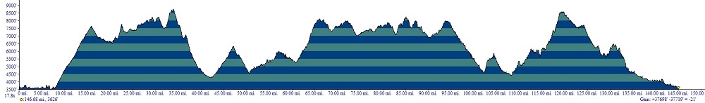
| Butcher Knife Ridge ** |
ST |
1+ |
| Divide Trail ** |
ST |
2+ |
| CS Ditch Creek/Divide, PG ** |
ST |
4 |
| Ditch Creek (bonus) ** |
ST |
2 |
| Twin Creek Ridge Trail ** |
ST |
1 |
| Divide Trail |
ST |
2 |
| Keystone Gulch |
ST |
1 |
| Thee Mlle Ridge ** |
ST |
1+ |
| Divide Trail ** |
ST |
2 |
| Powder Gulch * |
ST |
2 |
| Silverleads Ridge, PG ** |
ST |
2+ |
| Stein Mountain, PG *** |
ST |
3 |
| Divide Trail |
ST |
2 |
| Sheep Creek, PG ** |
ST |
2+ |
Day nine
is another short one, by Tour standards, but still 145 miles - of
great singletrack and fast transfer sections. It will take longer than
you think. There is no gas available anywhere other than North Fork. Count
on eight to ten trail hours if sawing is required (not uncommon). Some of the
D9 trails north of North Fork are not ridden a whole lot - and I have never gotten across any of them without some
sawing - even late in the season. The final set of trails west
of
Stein Mountain
close in early September.
Start your day by heading back west out of North Fork
along
NFD 030 8 miles to an intersection with Sage Creek
Road (NFD 005) on the right (north). Up near the top, there is a short
out and back to Ulysses Mountain LO (9Dxyz5).
You'll continue north and west and north along FS 055, 035 (Indian
Peak) and 347 (Indian Peak Summit). From the summit of Indian Peak,
you'll follow East Indian Peak (348) east, then north, to Butcher Knife
Ridge (6110). The D9 singletrack buffet begins here. You'll enjoy the next hundred miles.
Head north on Butcher Knife Ridge about five miles to the Divide Trail
(6106). Turn right, then go several miles north, then east, to Axe Park
Cutoff Trail (6107). Note:
It is extremely easy to confuse Axe Park Cutoff Trail with Hughes Creek
Trail (6113) as the former is poorly marked and and difficult to find,
while the latter is very well-traveled by motorcycles - despite being a
non-motorized trail.
At this point there is a bonus trail - Ditch Creek. It's the same as
the Challenge Section, but ridden downhill instead of up. It's a very
cool trail, but bumpy. Splendid views abound, up high.
|
|
Butcher Knife
Ridge.
|
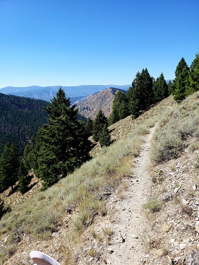
Sheep Creek
|
All
others will continue past Axe Park, along the motorized section of
Hughes Creek Trail, several pleasant miles to the Hughes Creek
trailhead. From
the Hughes Creek trailhead, it's a few miles southeast along Hughes
Creek Road (091) to an intersection with Ditch Creek Road (089) on the
left (northeast). Follow this a few miles north Granite Mountain
Road (092).
Just before you head to Granite Mountain Lookout you'll encounter the D9 Challenge Section, Ditch
Creek Trail (6112), which leads back up to the Divide Trail. Head
uphill along Ditch Creek for a few miles to Allan Lake, then
follow switchbacks up to an airy ridge. Why you
should ride it. More spectacular singletrack! Why
you should not.
This one is a gnarly pup on an otherwise
pleasant day. It's recommended that you visit the Granite Mountain CP
before heading up Ditch Creek, should you choose to do this CS. It's
difficult to obtain otherwise.
For all others, there
is a short out and back to the Granite Mountain LO, then follow Granite
Mountain Road (60092) nearly all
the way down to Hwy 93. Shortly before the highway, you'll encounter FS
449 on the left. Take it, generally north, many miles to the Twin Creek
Ridge trail (6109). Twin Creek Ridge is one of the best trails
anywhere.
Follow 6109 uphill for several miles back to the Divide Trail, then
follow the DIvide Trail north to the top of Lost Trail ski area. Take a
road around the south side of the slopes to the base area. From there,
cross Hwy 93 and head east along Highway 43 almost to Chief Joseph
. Locate Anderson Mountain Road (60081) on the left (south).
Follow this south several miles south to the singletrack CDT.
Just beyond the point where the singletrack CDT starts, there is a
bonus section available. I highly recommended this one, the
Keystone Gulch/Three Mile Ridge loop. Although longer than the section
of trail that it replaces, this loop is very much worth riding, if time
permits.
Either option leads to a fun section of the CDT, just east of 9Dxyz67. Follow this for several miles to Big Hole Pass.
From
Big Hole Pass, head generally west and downhill along Lick Creek Road
(078) several miles to 9Dxyz75 - Powder Gulch Trail. Powder Gulch, which leads over a divide to Sheep
Creek, will test your navigational meddle.
|
Once
over the top of the Lick/Sheep Creek divide and down into Sheep Creek,
turn left and head west down Sheep Creek Trail (6126) to Sheep Creek-Silverleads Road, on the left (south).
Follow this uphill several miles to a divide near 9Dxyz98. This is the
beginning of the Silverleads Ridge Trail (6134). Follow this uphill and
east to Stein Mountain Trail (6132). Stein Mountain is very steep -
rising over a thousand feet in a very short distance. The trail is mostly easy to follow, and yes, it really does go up there.
A challenge point awaits at the top at the Stein Mountain lookout.
Head east from Stein Mountain along a jeep road (071) to FS 256, on the
left. Follow this downhill to the CDT (Sheep Creek Trail 6129). Follow
6129 north several miles to an abandoned cabin in Bradley Gulch (a
Challenge Point), then backtrack a bit and ascend the southern flank of
Eagle Mountain, increasingly high above Sheep Creek, on Sheep Creek
Trail (6126).
You'll find sections of 6126 invigorating. I once encountered a bear
right in the middle of the biggest sidehill. Fortunately he was
uninterested in becoming acquainted, and released himself downhill into
Sheep Creek on his own recognizance.
Sheep Creek Trail leads back to the southern exit of Powder Gulch
Trail. From here, follow the trail, then road, out to Hwy 93. Once on
the pavement, it's a mellow cruise back to North Fork.
The
Village
at North Fork is, again,
your stop for the night. Get to bed early - D10 is a beater.
|
|
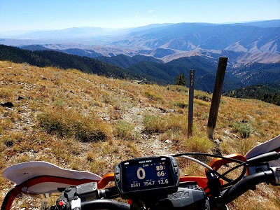 .
Stein Mountain
Trail
|
D10
- North Fork to Elk City/Lowell
(255 - 265 miles)
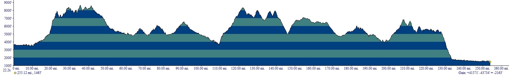
| Henderson Ridge ** |
ST |
3- |
| Divide Trail, PG * |
ST |
3- |
| CS Marlin Spring, PG * |
ST |
5- |
| 505 Trail |
ATV |
2 |
| Anderson Butte
Trail |
ATV |
2 |
Day ten, in a technical sense, is
one of
the
easiest days of the Tour.
It's long, but the major difficulties are all right at the
beginning. Budget ten hours to Elk City,
and another 90 minutes to Lowell. The biggest issue with D10 is
that it contains one of the two longest gas-less stretches
of the
Tour - about 210 miles (depending on the exact route taken). In fact
there is exactly one place for gas in the next 425+ miles, and that is
Elk City. Your
Giant
Loop fuel bags
will prove their
value in the next
two days. Many years of
bitter experience have taught
us that dirt bikes make particularly poor wheelbarrows when deployed
along the Darby-Elk City Road. You'd be amazed at how few people travel
that road, when you are out of fuel.
D10 has numerous alternate (purple on the map) routes. This is because
fires almost annually close areas around Elk City. That being the case,
alternative routes are mapped out for you in advance. At least one of
these generally works - though all are a good deal longer than the
standard route.
There is little to no cellphone service from most carriers between
North Fork and Superior, MT (the end of D11). There is WiFi at the Elk
City Post Office and the Three RIvers, in Lowell. Most cellphones will
work on the higher ridges along the Magruder Road (D10), and near Walde
LO (D11). Beyond that, you'll need to rely on you PLB and texting to
communicate.
Head
west out of North Fork
along
NFD 030 about 10 miles to an intersection with Indian
Creek Road (NFD 036) on the right (north).
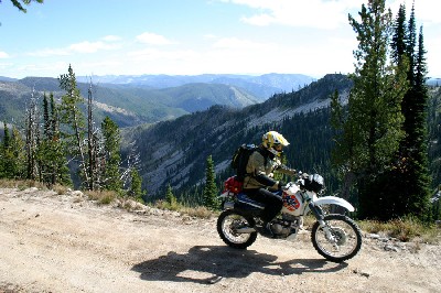
Magruder
Road
|
Head north about
six
miles until the Jeep road ends at a creek crossing. As improbable as it
appears early in the season, the trail does, in fact, continue on the
other side of the creek - albeit as an ATV trail. About a mile
and
a half further north the ATV trail crosses Corral Creek (which comes in
from the right). Shortly thereafte,r the route ascends through a few
switchbacks and turns into singletrack. It's a long, steep (1000' per
mile) three-mile climb up Henderson Ridge (6141) to the Divide Trail.
Henderson Ridge is not only steep, but it's littered with deadfall from
a catastrophic fire a few years ago. There is a trail there, but at
times it can be difficult to follow. If you absolutely cannot get
through you may backtrack to alternate "a" and head east to Butcher Knife Ridge and pick
up the DIvide Trail there.
Turn left (west) on the Divide Trail (6106) and head west a few miles
to Irishman's Rock. Here soloists may elect take a shortcut down Mine
Creek Road and Hughes Creek Road to the West
Fork Highway (473). This shortcut leaves out some nice singletrack but
does cut the distance to Elk City considerably. For solo riders, who
are hardest-pressed to carry supplemental fuel, this is the option.
|
|
|
A
bit further west and south along Divide Trail, two and three-member
teams will encounter the D7
Challenge,
Marlin Springs Trail (6069). It's a huckleberry.
Why you
should ride it.
Because you are the greatest rider no one has ever heard of and you are
going to prove that the
Tour isn't all that. Why
you
should not. You'll
be there a while. Although this trail has been cleared and rerouted in
the past few years, the last time I rode it, it was a bear.
Others
will continue
south and west along Divide Trail a
few more miles
to an intersection with Spring Creek Road (038). It's a little bumpy
towards the end, but that section is short.
Head north to
on Spring Creek Road to NFD 044 near
Beartrap Ridge
(8303').
A bit north of this is Blue Nose Lookout (8677'). Follow NFD 044 north
5.5 miles to Horse Creek Pass
(7400') on the Idaho-Montana border. Turn right (north) and
head downhill
along Beaver Creek 10 or so miles to West Fork Highway (473), which is
paved. From the intersection of NFD044 to
Nez Perce
Pass you are in Montana.
Turn
east (right) onto 473
and
follow it generally north for several miles past the community of
Alta to mile-marker 26 (just south of Painted Rocks
Reservoir).
Turn left (west) onto NFD 5660 (Coal
Creek
Road) and
follow it past
some homes (please respect the privacy of these homeowners and take it
easy while riding the right of way through their properties) for about
a mile to an intersection with NFD 5658 on the right. Turn
right
at
this intersection and go several miles
as Upper Coal Creek
Road skirts the south and west shores of Painted Rocks Reservoir on a
scenic ridge high above the waters.
Eventually
the road
descends
into a valley and intersects with NFD 362. Turn left on NFD 362 and
follow it a short distance to the first road that veers off to
the right. Follow a series of well-marked roads 6 miles up
to Tough Creek Saddle. From Tough Creek Saddle follow the road
the
goes north then west descending steeply down to the Nez Perce
Road.
|
|
Henderson Ridge
|
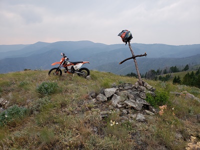
Bald Mountain
D10 Challenge Section
|
You
are beginning a trek through the heart of the largest contiguous
wilderness area in the lower 48 states - the Frank Church. Head west on
Nez Perce (also know as the Darby-Elk City Road) to Nez
Perce Pass (6597'). This
pass marks the approximate halfway
point of the Tour
of
Idaho. Go
west 15 miles downhill to the Selway
River, then another 5 miles to the Magruder Crossing Campground and an
intersection with NFD 6223 on the north (right). Go left
(south)
continuing along the Nez Perce Road and the Magruder Corridor. The road
climbs a long grade 5 miles to Kim
Creek Saddle
(6000'). Continue a few more miles to Salmon Mountain
(8228').
Salmon
Mountain Lookout contains a bonus Challenge Point - but you have to
hike to get there. The Salmon Mountail
Trail (FST 705) is a 1.2 mike trek that gains about 700 feet.
If
any part of the Tour is closed by fire, or you've made a riding or
navigational error, this is a relatively easy way to make up a
CP.
Continue
along the Nez Perce/Magruder Corridor/Darby-Elk City Road (video)
40
miles, generally west, to Dry Saddle. There is a short out and back
near here to Burnt Knob Lookout (8196'). After
this
descend steeply into Poet Creek then trek an interminable number of
miles along the world's most dangerous dirt road looking
for
an
ATV trail (505)
that departs the road north less than a mile from Mountain
Meadows. |
The
505/835 ATV trail network is one of the better ones along
the Tour.
Follow the 505 north several miles to Soda Creek
Point. Continue as the trail gradually follows a
series of
switchbacks
down the mountain to Red River and FS
234, Hot Springs Road (note: Red River Hot Springs
is 2.5
miles northeast along the road 234 at this point. There are supplies
there but no gas pumps.
Turn
left and head
southwest on FS 234 a mile or so to an intersection with Divide
Road (FS 423). Turn
right and head west then north a few miles to an intersection
with the 505 ATV Trail near Black
Hawk
Mountain (video).
Until
2016, the Tour continued past Black Hawk Mountain
directly to Lowell. Unfortunately the only gas
station
in Lowell is now closed. That being the case, you'll probably have to
take
the 25-mile detour
west into Elk
City for gas. The network of roads, single track trails, ATV trails and goat trails
around Elk City is a complex maze. I've ridden these trails dozens of
times and I still have trouble in places. That's because there are
trails literally going everywhere - often within a few feet of each
other. In places there will be a road, an ATV trail and a single track
all going in the same direction a few yards apart. The best route in and out of Elk city is the regular route shown on the map.
Elk City is a pretty remarkable place. It's remote, and as
such, is well-stocked in order to keep the locals from having to make the
horrendous drive to the nearest town. You'll
find gas,
food and some supplies if you look around. You'll want to take
on
as much gas as you can carry at Elk City because it's 225+ miles to the
next gas
along the Tour route. You are free to stay in
Elk City, instead of Lowell, if you choose. I've done it both ways. If you choose Elk City, try the Elk City Hotel.
After Elk City, you'll ride to Anderson
Butte. There is a bonus trail in this part of the route. After
this go northwest 10 or so miles along the Anderson
Butte
Recreational Trail (835) to NFD 443 (Note: There is a right turn just
north of Anderson Butte that is not completely obvious).
Continue
north on
NFD 443 a short distance to an intersection with NFD 464 on
the west (left). Turn east (right) and continue along NFD 443
another 6 miles until the road narrows near
Falls Point. Here the road takes an
amazing 3800' plunge in 7 miles to Selway
Falls.
Once in the valley follow the Selway River downstream a mile or so to
a bridge crossing. On the other side of the bridge turn northeast
(left) and follow the Selway
Road downstream some 14 miles to Lowell.
Note: Falls Point road is closed a lot. It's the quickest and shortest way from Elk CIty to Lowell,
but the other variations will all work.
Lowell
is a small
community with a motel and a restaurant. As of 2016 the gas
station/store (Cougar Station) is closed. The Wilderness
Inn and Three
Rivers Resort are your options for lodging.
Lowell
is the lowest
elevation of the Tour at 1450'.
D11
- Lowell
to Superior/St. Regis
(200 - 250 miles)
| Pete King Ridge * |
ATV |
1 |
| Pete King Creek * |
ST |
2 |
| Fish Butte, R ** |
ST |
4 |
| Fish Butte |
ATV |
1 |
| Sherman Creek, R * |
ST |
4/3 |
| Fish Creek, R * |
ST |
3+ |
| Ant Hill |
ST |
5/3 |
| Windy Ridge ** |
ST
|
3 |
| Windy Bill * |
ST |
3 |
| Raspberry |
ST |
3 |
| Marten |
ATV |
1 |
| Switchback Hill/Scurvy
Mountain |
ST |
4/3 |
| Junction Mountain
|
ST |
3 |
| Weitas Creek * |
ST |
2 |
| Lunde Ridge/Rock Garden * |
ST |
4/3 |
| Pot Mountain Ridge * |
ST |
4 |
| Elizabeth Mountain |
ST |
3 |
Note: dual ratings indicated a significant difference in difficulty between direction traveled, generally up vs down.
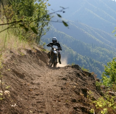
Pete King Trail |
Day eleven is high
adventure - and your last really long day. You'll
want to get an
early start, as the shortest distance to Superior is bout 200
miles. Much of D11 is
spent on single track trail that, though
mostly moderate, is relatively slow going. No fuel is readily available
anywhere between Elk CIty and Superior, but there are numerous
campgrounds along the route that are normally full of ATVs, UTVs and
motorcycles, during Tour season.
From
Lowell, go east on
Highway 12 about 2
miles to Pete King Creek. Head up the creek for about a mile
where the routes diverge for the first time on D8. Two and three-member
teams will continue up Pete King Creek to FS 101. Soloists are allowed
to turn right (east) and climb steeply along an ATV trail for
several
miles to Pete King
Ridge and an eventual intersection with FS 460. Follow 460 for
a
few miles west toward Higgins Hump then take FS 5515 a few miles north
to Fan Saddle and an intersection with FS 101.
After a short side trip
to Walde Lookout (the challenge point is up the ladder and in the
tower), continue
north several miles along FS 101 to Canyon
Junction.
From Canyon Junction you have your choice or routes to take. All Tour route options are marked on the D11 100K map,
in black. You may take any of these routes - though some are transfer
sections and do not add to your point totals. There are 12 CPs, but no
CS. One, two and three member teams will all have a different number of
trails and CPs required. Refer to the 2022 CP page.
|
Not all of the trails available to you between Canyon Junction and
Cedars are equal. Some are long, some are short, some are difficult and
some are easy. Some of the CPs are much easier to get to than others.
It's up to you to plan and execute the best route for you through this
area. All of the trails are of very high quality. It's difficult to go
wrong.
To
obtain credit for riding a trail, you must ride the entire section of
the trail marked with a letter designation (e.g., "b"). Some trails are
divided into multiple sections and you may obtain more than one point
for the same trail by riding the different sections. You may ride a
trail in either direction, trail loops in either direction, or even do
out and backs as long as you complete each section. You really have
complete freedom to plan a route through the middle of the day.
There are 23 optional routes between Canyon Junction and The Cedars The
following routes are worth 1 point each: b, c, e, f, i, j, k, l, m, n,
o, p, q, r, s, w. Routes a, d, g, h, t, u, v are allowed transfer
sections. Solo riders must complete routes adding to a minimum of six
points, two member teams must accumulate a minimum of seven points, and
three member teams a minimum of eight points. Any additional bonus
sections ridden count as true bonus sections adding to your cumulative
total.
There are 12 CP's, descriptively named in the waypoint file. To
earn a CP, you must, in general, avoid "poaching," i.e., riding along a
jeep road to access that CP, unless that's the only option. Castle
Butte LO, for instance, may only be approached by a jeep road. But Fish
Butte, which may be reached by a jeep road, also has single track
trails, at least one of which you must ride, either to or from the CP
if you are going to claim it. |
|
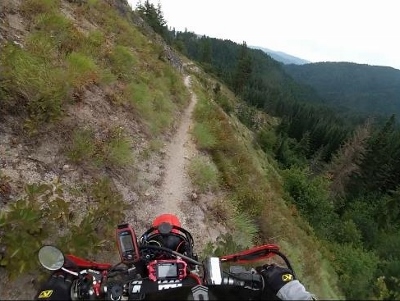
Fish Butte
Trail |
 Scurvy LO Scurvy LO |
Sawing will be an issue on some of these trails - which are lightly ridden.
All
route options converge near Moose Creek Road (FS 250) just south of The
Cedars campground (this is a good place to scrounge for fuel). From The
Cedars, take FS 250 up over the divide at Hoodoo Pass and about another
40 miles to Superior, MT. You may stay in either Superior or St.
Regis, though I recommend Superior.
Superior is a good-sized
little town with many motels and restaurants. You'll probably be
getting in pretty late, so be sure to let them know that where ever you
are staying.
Congrats!
Once you reach Superior, the worst is almost over. D12, though more
involved than the distance might suggest, is mostly a blast. Some of the
D12 trails are among our personal favorites. |
D12
- Superior/St. Regis to Wallace
(175 miles)
| MT1, PG ** |
ST |
3 |
| MT2, PG ** |
ST |
3 |
| MT3, PG *** |
ST |
3 |
| MT4 S
R ** |
ST |
4 |
| MT4 |
ATV |
1 |
| MT6,
PG * |
ST |
3 |
| MT7 |
ATV |
1 |
| MT8 |
ST |
3 |
| MT9 |
ST |
3 |
| MT10 |
ST |
3 |
| MT11 |
ST |
3 |
| MT12 |
ATV |
1 |
| MT13 |
ATV |
1 |
| MT14 |
ST |
3 |
| CS |
ST |
4+ |
| MT15 |
ST |
3 |
| MT16 |
ST |
3 |
| MT17 |
ST |
3 |
| MT18 |
ATV |
3 |
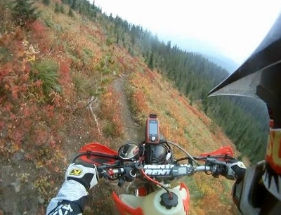
|
Day twelve
is your last hard day. It's also a day for another early start
as you'll want
to arrive in Wallace, the penultimate daily destination and northernmost "big city" on the Tour,
early enough to enjoy the hospitality of Donna and her staff
at
the Ryan Hotel. You'll be celebrating your impending
Tour of Idaho finish with a nice meal at
any of a dozen
splendid eateries if you
make it to Wallace without incident. Twelve hours ought to do
it.
D12
is another mystery day once you leave St. Regis.You will receive trail directions before you depart Superior/St. Regis
on the morning of D12. No map and no waypoints will be made available.
You must turn off public tracking before leaving St. Regis, and leave it off until D13.
D12 contains a lot of
single track, with a few fast transfer sections. Most of the trails are
moderate in difficulty but very, very scenic. There is
no gas available anywhere in the 175
miles between St Regis and Wallace. There are CP's to be acquired, several bonus sections, and a CS, all TBA.
|
The
only pressing D12 issue is that your tires, among other things, are likely
toast at this point. The number of teams historically experiencing tire
or mechanical failure on D12 is large.
Wallace, at the end of D12,
is a
historic mining
town with a population of about 1000.
It's generally brimming with
tourists and there are a variety of accommodations available.
It's one of the best towns along the entire Tour in which to
spend some
time.
We recommend the Ryan Hotel
for
accommodations where
Donna and her staff will treat you right.
Ethanol-free gas is available at Beamis
Hi Co.
Congrats,
you are almost
done!
|
|
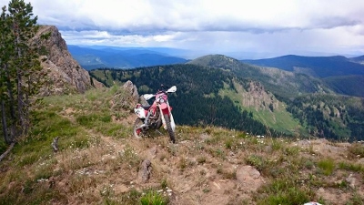 |
D13
- Wallace
to Sundance Mountain
(180
miles)
| Graham Ridge |
ST |
1 |
| Graham Creek |
ST |
2 |
| CS Independence Creek, PG
* |
ST |
3 |
| Bunco Pass |
ATV |
1 |
Day
thirteen
- your last day on the Tour. Gas, food and
water
are not a problem as
there are frequent highway crossings and small towns all along
the
way. It's the easiest day of the Tour.
Mostly it's a long transfer section to get you to Sundance Mountain and
the Selkirks (a beautiful mountain range virtually unknown beyond the
area). About the only harp out of tune in the heavenly orchestra is
that it's not overly difficult to get lost in maze after maze of
logging roads you'll encounter. Though
not difficult, the riding is scenic, relaxing and enjoyable. It's a
good last day. Plan on eight hours to Sundance and a bit more to return
to
your shuttle in
Priest River.
From downtown
Wallace,
take 6th street north under I-90 to 9-mile
Road/NFD 456 and follow it
north. After three miles 456 (which is paved) heads uphill through a
series of curves while 9-mile Road veers left and becomes dirt.
Continue along 9-mile Road a short distance as it ascends through a
series
of
switchbacks
to an intersection with NFD 424. Turn west (left) on NFD 424 and follow
it 16 miles as it winds northwest to Moon Saddle. Your GPS
track
will prove invaluable in keeping you on route through the maze of
logging roads that criss-cross this area. From Moon Saddle (4669') head
west (left) a short distance and find Graham Ridge Trail (17) which
heads west a short distance to the top of Graham Creek Trail
(33).
Follow Graham Creek downhill and north about 5
miles as it descends to the Coeur D'Alene River Road (NFD 9).
Proceed east
(right) on NFD 9 for a few miles to a river crossing. Immediately on
the
north side of the bridge you'll encounter NFD 503 (Old River Road -
County 1 C) on the left. Head west along this road and look
almost
immediately for an intersection with NFD 207 (Brown
Creek
Road). Go northwest a few miles to Brown Creek Saddle, then
north
a
few more miles to along FS 993 to
Grizzly Ridge.
Continue
north along
Grizzly Ridge Road (NFD 260), then to Flat Creek Saddle and
Grassy
Mountain,
then north on NFD 265 to Spyglass Peak Lookout. The road
then
heads west a few miles to Big Meadows and the Magee Historic Site - a
nice spot to rest for a bit. From
here you may turn right (north) and follow NFD 6310 a few miles
to the challenge
section for D13, the Independence
Creek Trail.
Why you
should ride it. One of the easier challenge
sections. All the way up north guys love it. Why
you
should not. This trail is
an example of
what happens when surrounding trails are closed - funneling a
lot of traffic onto one trail.
Independence Creek is
rutted, beat to death in spots and less than great except for
a
really
spectacular climb near
it's end. |
|
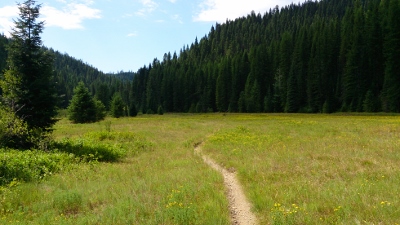
Independence
Creek |
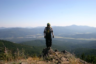
Hoodoo
Mountain - Challenge Point view |
For those staying on the
main route it continues west along NFD 534,
the Cascade Magee Road, to Hamilton Creek/Hamilton Mountain Road (436)
on the right (north). Follow this 7+ miles to Crooked Ridge Road (258),
then head north a few miles to Bunco Road (332).
Follow
Bunco Rd. (NFD 332)
across Prospect
Peak. Just beyond here, and just at the point Bunco Road drops into the
valley to the west, the routes diverge for one last time. Please note
that the Bunco Pass ATV trail closes on 9/5 and after that everyone
follows the same route down to Bunco Corners.
From Bunco Corners turn north (right) on Goodhopper Road and proceed
0.5 miles to
Belmont Road. Turn west (left) on Belmont and proceed a mile to N.
Lewellen Creek road 1.5 miles to SR 54. Turn left (west) and proceed
three miles to an
intersection with US 95. Proceed across 95 to the town of
Athol -
a great place
for a brief lunch and fuel before the last push north. The last time I
was there the Thai food in the gas station was outstanding. |
Head
west out of Athol on
Watkins
Ave./SR 54. Go 1.5 miles to an
intersection with North Clagstone Road on the north (right). Take
Clagstone Road north and east 10 miles to an intersection with Spirit
Lake Cutoff. Head west (straight) through this intersection and
continue along
Clagstone Road another 1.5 miles to an intersection with
Blanchard Cutoff Road. Turn west (right) and follow this road a little
less than a mile to NFD 2550 Road on the north (right). This
is
the second dirt road on the right and is marked with a sign that has an
anvil on it.
This
is
the heart of Ruby Ridge country and it would be best if you
didn't
get lost. That tune that keeps running through your head, the one that
you can't quite place - it's Dueling
Banjos.
Follow
NFD 2550 as it winds
it's way
7.5 miles up to the summit of Hoodoo
Mountain
(4665') which is the first challenge point of the day.
You'll have to backtrack about a mile from the summit to find the
continuation of NFD 2550 that descends the north side of the mountain
to Priest River. Follow NFD 2550 down some 15 miles to an intersection
with Dufort Road on the south side of
the Pend Oreille River. Follow this road west 3 miles along
the
southern bank of the Pend Oreille to a bridge that crosses the river
north to the town of Priest River.
Priest
River is the best
place to have a
shuttle waiting. It's also the the last chance for gas before the final
sprint into the
heart of the Selkirks. Mitchell's
Express has
ethanol-free gas.
Take US 2 east out of the
town of Priest
River. About a
mile east of town
look for
an intersection with East Side Road (W43) on the north (left)
side
of the highway. Proceed north 12 miles to an intersection with W39
(East River Road). Turn north (right) and proceed 11 miles toward
Coolin.
About a mile or so south of Coolin, look for the Sundance Mountain Road
on the right (east).
Follow this
route uphill
a few miles to an intersection with 207. Take
this jeep road steeply uphill a few miles to the majestic Sundance
Mountain Lookout. Enjoy the splendid views of the Selkirks and Priest
Lake. You've made it. Your last challenge point of the Tour is in the
tower. |
|
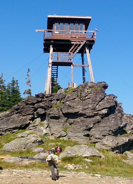
Sundance
Mountain
|
If you get
to Sundance
early enough it's not a bad ride up to the
original end of Tour north of Upper Priest Lake, then back down the
west side of the lake back to Priest River. This loop, however, adds
another 80 miles to the end of the day.
The Eagle's
Nest Motel is
the best inexpensive lodging near the end of the Tour. There are several places in Coolin that are very nice as well. The Travel
America RV Park in
Sagle (about
20 miles east) is the best place
near the end of the Tour to park a rig that you plan on leaving for a
week plus.If you are doing a self-shuttle, this is your best
bet.
|
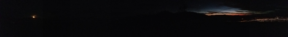
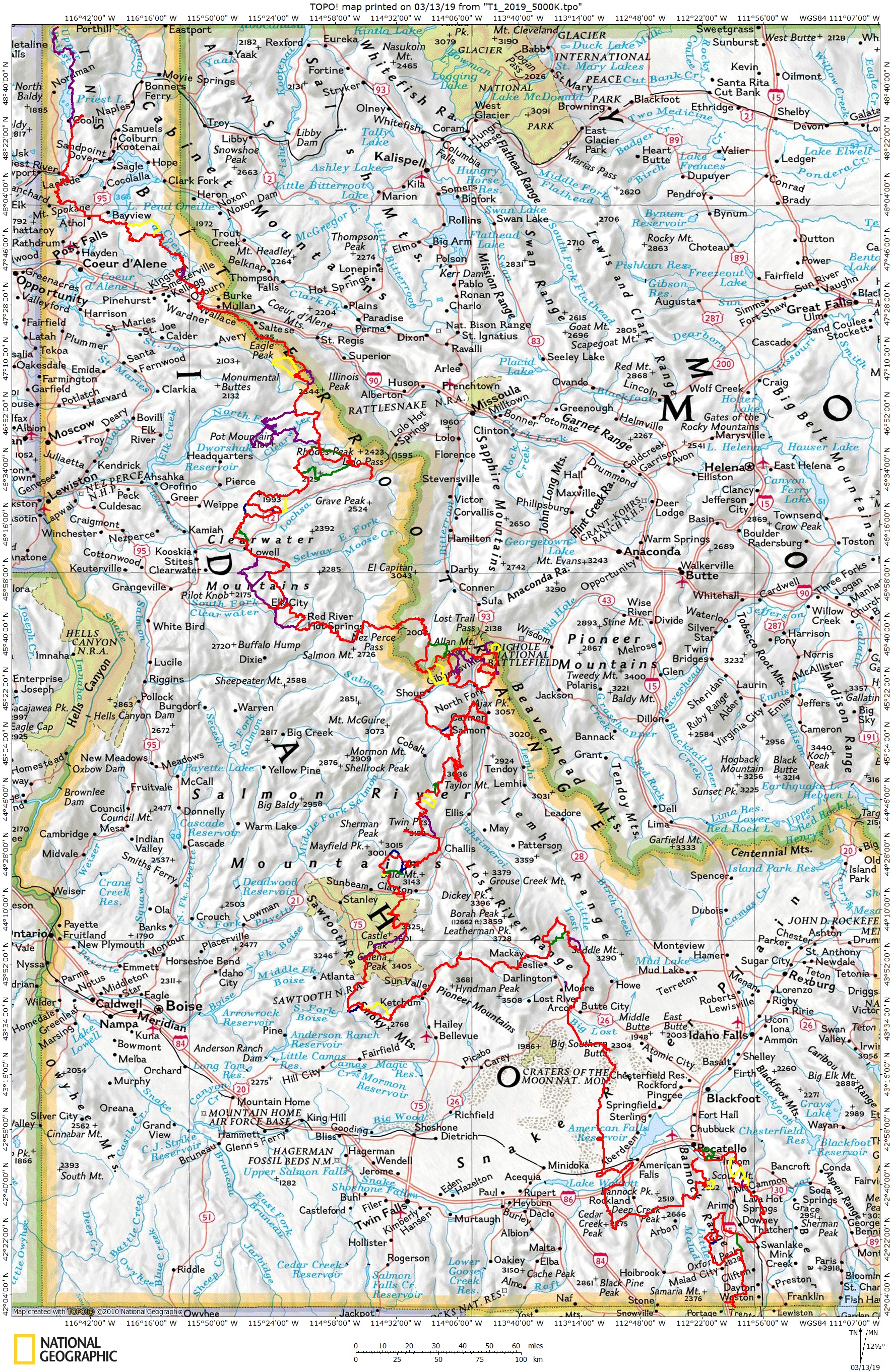


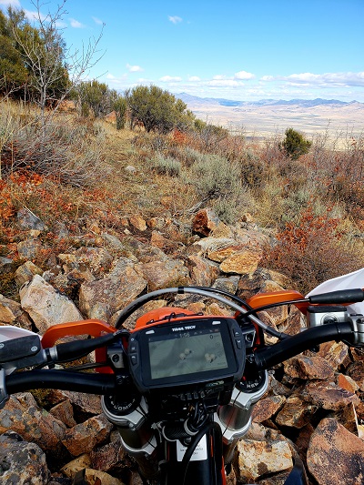
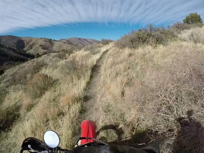
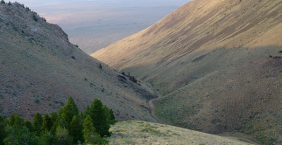
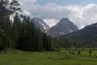
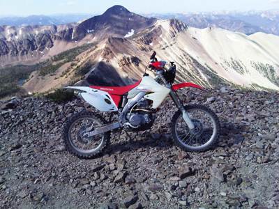
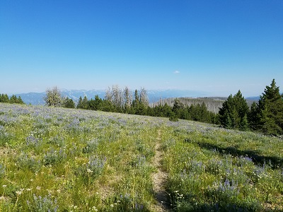
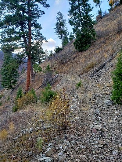
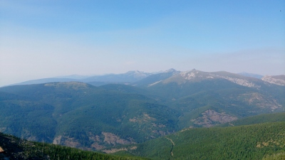