| Home | Rides | Reviews | Bikes | Gallery | Tech | Misc | Contact |
| The
Mojave Trail by Martin Hackworth Photos: Dan Colvin, Martin Hackworth, Steven Verschoor |
 |
|
|
 |
|
The
140-mile Mojave Trail (a.k.a. the Mojave Road) is a popular
dirt bike/dual sport
ride through the Mojave National Preserve. The Mojave Trail
traverses not only a cross section of desert terrain but of human
history as well. The web abounds with information about the Mojave
Trail and a brief Google search will yield many useful
resources.
A GPS map of our route is available here.
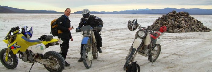
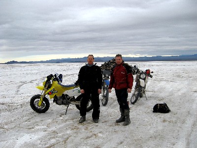
We chose to ride the longer 175-mile Laughlin to Barstow route, both ways, on consecutive days. The bulk of the information on the web concerning the Mojave Trail is aimed at the Jeep/ATV/dual sport crowd and we found that most length of time estimates for the journey (several days) to be overstated. Unless you are traveling in a wagon train the trek takes only a single day on any actual dirt bike - even during winter. We started our trip off proper with a luxurious night's rest in the AVI Casino on the banks of the Colorado River near Laughlin, NV and departed directly from there the next morning (the folks at the AVI allowed us to leave our truck and trailer in their parking lot overnight). The AVI has great dining, movies, clean rooms, comfortable beds and, of course, gaming if that's your bag. We give it two thumbs up. We set out on December 28, 2007. Dan and I had trailered our bikes down from Idaho the day before meeting Steven, who rode over from LA, at the AVI. Dan and I were eagerly anticipating relatively balmy conditions having left a foot of snow and a month's worth of below freezing temperatures behind in Idaho. |
 |
My first sense
that
something might be amiss occurred just before our arrival when
we stopped the truck in the
mountains north of Laughlin for a bathroom break and
discovered that
the temperature had only changed about 5 degrees F from Idaho - and it
was colder.
But it
was after dark in a mountain pass, we rationalized,
and laid
our heads to rest that night with the certain knowledge that the
morning would
bring the warmth we sought. Horrible fevers gripped me during the night and the daylight arrived with a full blown case of the flu. Things got even better when we walked outside to a temperature of 37 degrees. My XR600R requires an enthusiastic bump start anywhere south of 50 degrees and it took three trips to the top level of the parking garage to breathe life into the beast. You can access Old Government Road easily from the Aha-Macav Parkway right out of the casino parking lot. The first 20 or so miles of the trail traverse the range of hills west of Laughlin along the Nevada-California state line. After crossing into California at the crest of the hills the road heads west toward US 95 and the Piute Valley. |
|
After
crossing US 95 Old Government Road ascends gentle slopes on
the
western side of the valley toward the Piute Mountains. It was here that
Dan got the scare of his young life when he came over a
rise at a yeoman's pace of 60 mph to discover an unfortunate
feature of
recent heavy rains in a desert environment - a 3 foot deep gully across
the entire width of the
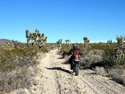
road. A gated road requires a detour south from the Mojave Trail at Fort Piute so we crossed the Piute Mountain crest at the next pass south. While climbing toward the pass on Cable Road we encountered a traffic jam of 4WD vehicles and discovered at it's head a truck nose down in another newly formed gully in an attitude reminiscent of the final moments of the Titanic. After crossing the pass we entered the Joshua Tree covered Lanfair Valley and reconnected with Old Government Road. At times the sand in this section of the road was quite deep and there was little evidence of any firmness from the recent rains. |
 |
 |
After 20 miles
of Joshua Trees and sandy expanses we encountered the
Ivanpah-Lanfair Road. A short jog to the south and we again headed west
on Government Road toward the New York Mountains. Here the
trail
intersects the Cedar Canyon Road - a veritable
dirt superhighway
that provided rapid transit to the Kelso-Cima Road.
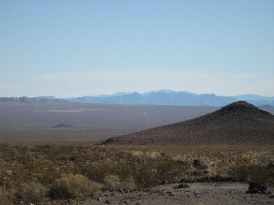
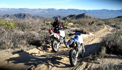
It's here, 60 miles from the Colorado River, that the riding really began to pick up. Ahead was a spectacular landscape that included the Kelso Dunes, the Beale and Marl Mountains and Cima Dome. But what interested us were the whoops - at least 10 miles of them up to Marl Springs and beyond. Even the flu couldn't put a damper on the specter of the vast sandy playground that wound through Joshua Tree festooned hills into the distance. After miles of smiles we reached the pass near Powerline Road and were greeted with a vista of Soda Lake, the Devil's Playground and Baker off in the distance. |
|
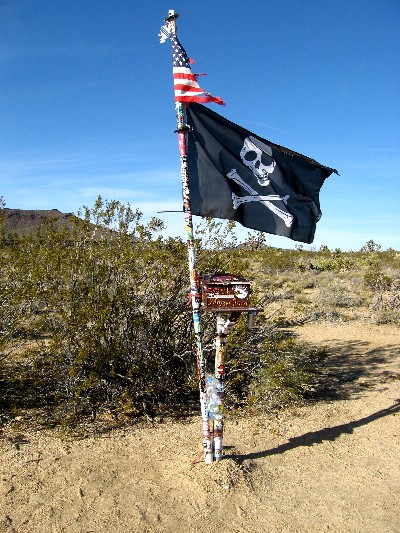
Not far from the top of
the pass we encountered the famous Mojave
Road Mailbox (right) and John
Hancocked the register.
The
next section of trail, the Willow Wash, included more deep sand. Here,
however,
the sand occurred in patches between firm and often rocky terrain that
wound
through ancient lava flows. There was no choice but to yard on our
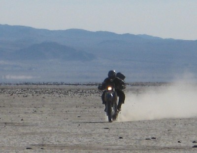
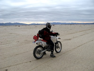
throttles and hang on. Mondo excitement. After another 10 miles we encountered the KelBaker Road crossing and proceeded west to Hidden Valley Road. Another 20 miles of sandy expanses and we encountered one of the most impressive features of the Mojave Trail - Soda Lake (formally Lake Tunedae). Soda Lake is a vast seasonal lake south of Baker, CA (during rainy season you have to ride around the lake). The Mojave Trail crosses the southern part of the lake from east to west but it's worth your while to ride north across the dry lake bed to Baker for gas and lunch. The group of buildings north of the trail on the western side of the lake have an interesting history. They were formerly the site of the Zzyzx Mineral Springs and Health Spa and now the Cal State Desert Studies Center. The mineral springs are located at the end of Zzyzx road which follows the western shore of the lake north to 1-15. The name Zzyzx was given to the area in 1944 by Curtis Howe Springer who established the Mineral Springs and Health Spa. Unfortunately the spot he chose was was on federal land that he failed to gain permission to use. For 30 years Springer used the springs to produce bottled water and imported animals from around the country to attract visitors to Zzyzx. Springer squatted on the Zzyzx ranch until 1974 when he was arrested by U.S. Marshals for misuse of the land as well as alleged violations of food and drug laws. Afterward the land was reclaimed by the government and is now the site of the Desert Studies Center. |
 |

 |
We
spent quite a bit of time playing around in the dry lake bed but it was
very cold and the day was growing long. The cold weather was the
greatest factor motivating our desire to get to Barstow before dark at
all costs. The consequences of any further drop in the temperature were
just too awful to even consider. Anyone who tells you that you can't
freeze your tush in the Mojave hasn't tried.
The trail west from Traveler's Monument, a large rock cairn in the middle of the lake, took us quickly to a sandy wash that led to the Rasor OHV area 103 miles from the Colorado River. Several promising sand dunes were scattered around but we still had serious miles ahead and little time to spare in the waning daylight. Not far from the Rasor Dunes we entered the Afton Canyon following the railroad tracks west. Afton Canyon is a wildly scenic place with some of the most interesting riding of the entire trip and several water crossings. We followed the low rays of the winter sun for about 20 miles to Afton Canyon Road and in the fading daylight entered the Mojave River wash. This we followed through many interminable miles of deep sand in gathering darkness to Manix Wash and the end of the trail at Yermo road. |
|
We
rode the Yermo Road for about 10 miles and got on I-15 at
Yermo where we enjoyed some post-dirt thrills lane splitting through
slow moving
freeway traffic entering Barstow. By the time we arrived at
the hotel
I
was so cold that I could barely remove my gloves and helmet. The next day arrived with warmer temperatures - a relatively balmy 50 degrees. We enjoyed a leisurely breakfast and were back in the saddle at the crack of 10 a.m. The return journey, replete with generous sunshine, revealed fresh aspects the landscape and a much more pleasant ride. It's a lot easier physically to rack up the miles when temperatures are in the mid 50's than it is when they are in the mid 30's. The day passed pleasantly and rapidly. We took a more direct route back across the Piute Valley - straight as an arrow from the end of Cable Road to the hills above Laughlin. Even though this route is well south of Old Government Road it's a much better alternative being shorter, faster, better riding and more scenic - especially close to Laughlin. |
 |
 |
We
rolled into the
parking lot at the AVI about a half hour before dark. All in all it was
a great couple of days. The Mojave Trail is one of those rare
adventures that happens to be all that it is cracked up to be. The only
thing is that we'd recommend staying home if the temperature forecast
is below 40 degrees. I'm sure that this isn't a problem most of the
time. The Mojave Trail gets the official MoJazz seal of approval and six thumbs up. Related Stories: The Mojave Preserve Loop, The Mojave Road 2010 The Mojave Mailbox Facebook Page, the Mojave Road Facebook Page and our extensive collection of Mojave Road YouTube videos. Rides Reader Forum |
| Home | Rides | Reviews | Bikes | Gallery | Tech | Misc | Contact |