| Home | Rides | Reviews | Bikes | Gallery | Tech | Misc | Contact |
| T3
-
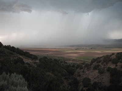
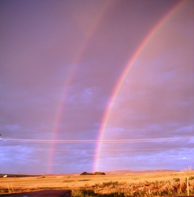
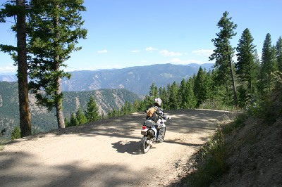
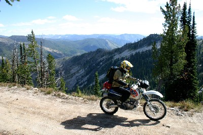
The Dual Sport Tour of Idaho T3, the 1700-mile dual sport version of the Tour of Idaho, begins in the Malad Range of southern Idaho and ends in the Selkirk Mountains near the Canadian border. T3 is basically T1 without most of the extremely technical trails and follows much of the same route. It is very likely one of the most adventurous dual sport rides in the United States and without a doubt one of the most fun. T3 is not as demanding as the Tour of Idaho (T1) but much more difficult than the Idaho BDR. T3 is appropriate for most riders on anything but the largest adventure bikes. The most difficult trails are all quad trails. There are a couple of single tracks along the way (easily bypassed) but they are almost completely non-technical and generally downhill. Street legal bikes are required. Idaho has some new requirements for off road motorcycles. If your bike is plated out of state you should be fine. Click here to check the rules. Most of five to seven days normally taken to complete T3 is spent in wilderness areas far from the nearest town (including the largest designated wilderness in the lower 48 states). Cell phones are useless much of the way. Water, food, emergency supplies and fuel must be carried and bikes and riders must be capable of a 250+ mile range. T3 encompasses extremes of elevation (1486' at Lowell to 10,440' at Railroad Ridge) and climate. Technical challenges include mud, snow, rocky atv trails, numerous water crossings and sand. The variety of plants, animals and geological features found along the way is amazing. The riding is varied, challenging and always interesting. T3 is generally passable by mid July and remains open through early October during most years (though some trails close in late September for hunting season). There is a distinct possibility of blistering heat, brutal cold and deluges of biblical proportions, rain or snow, along the entire route (often within just a few hours) during the entire riding season. Resources: 500K map, 100K south, 100K central, 100K north, .gpx file. You
are free to use all of the information here anyway that you wish. We
ask only that you spend some time exploring the information here (there
is a lot) before you email us with questions. |
|


|
|
| Idaho-Utah
Border Jenkins Hollow (5762'). Mile 0 |
 |
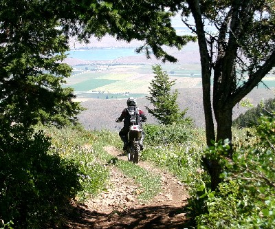
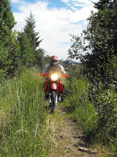
| Twin
Lakes Emerging from the trees just below the summit of Old Baldy (7500'). In the background is the town of Clifton, ID and Twin Lakes Reservoir. |
 |
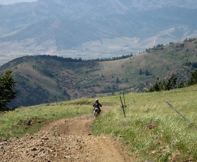
| Oxford
Ridge Beginning the spectacular climb up Oxford Ridge. |
 |
| Oxford
Ridge The Oxford Ridge trail straddles the Oneida/Franklin county line (8281'). The city of Clifton, ID and Twin Lake Reservoir lie in the background, some 4000' below. |
 |
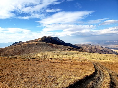
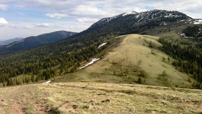
| Oxford
Basin Oxford Basin in the fall (7000'). |
 |
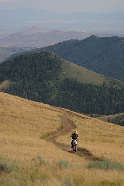
| Sedgwick
Peak Descending from the summit of Sedgwick Peak (9167') along the Portneuf Range Crest toward Lava Hot Springs. |
 |
| Inkom
Pass Cresting the knoll above Inkom Pass (7500') along the Portneuf Range Crest. |
 |
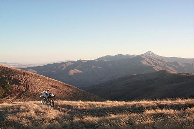
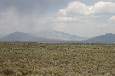
| Chinese
Peak/Scout Mountain Looking south toward Scout Mountain (8700') from Chinese Peak (6459') near the top of Blackrock Canyon. |
|
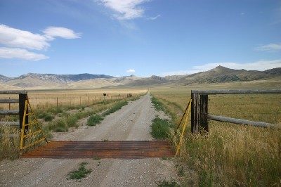
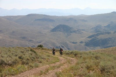
| Arbon
Valley Lusk Loop, Arbon Valley (5415'). |
 |
| Rockland
Valley Approaching Rockland Valley (4872'). |
 |
| Flint
Canyon Flint Canyon, Sublett Range (5563'). Mile |
 |
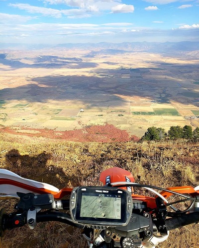
| Desert
Vista Challenge point near Fall Creek. |
 |
| Fall
Creek Looking north toward the Snake River from Fall Creek (4600') in the northern Sublett Range. |
 |
| American
Falls Just west of American Falls on the south side of the Snake River (4417'). |
 |
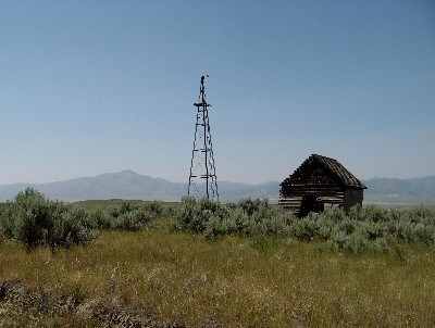
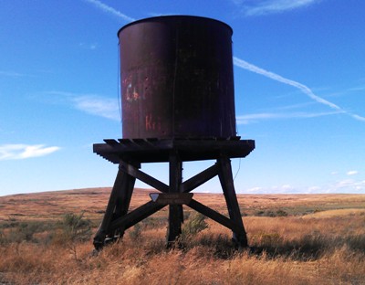
| Gasten-Beattie
Well Middle of nowhere, Snake River desert. |
 |
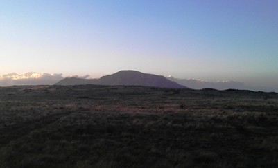
| Big
Southern Butte Big Southern Butte, a prominent landmark along Goodale's Cutoff, rises 2500 feet above the desert floor and dominates the Snake River Plain for a hundred miles in any direction. |
 |
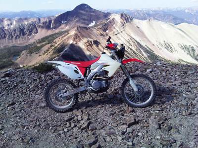
| Big
Southern Butte The view from the lookout on top of Big Southern Butte (7517') in June. The road to the top is steep in sections but suitable for all motorcycles. |
 |
| Big
Lost River The view north toward King Mountain, 20 miles west of Big Southern Butte. |
 |
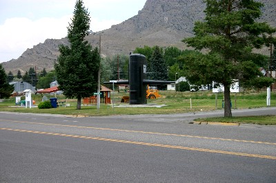
| Arco Arco, ID - population 1026, elevation 5325'. Plenty of submarine parking. US 20 is in the foreground. The road out of town toward Arco Pass is in the front of the sail. Arco is a full-service, dirt bike friendly town. |
|
| Arco
Pass Road Approaching Beverland Pass. |
 |
| Pass
Creek Near Pass Creek Summit at an elevation of 7722'. |
 |
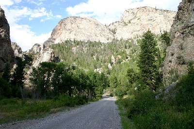
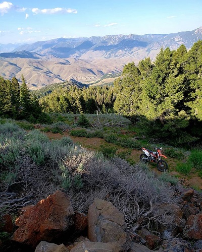
| Pass
Creek Pass Creek Canyon (6222'). Pass Creek road descends 7 miles from Pass Creek Summit. |
|
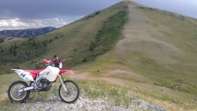
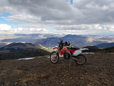
| White
Knob Mountains A 10,000' pass above Mackay. |
 |
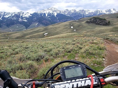
| Wildhorse
Lookout (9545'). Pioneer Mountains in the background. |
 |
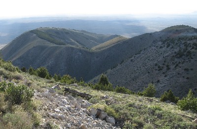
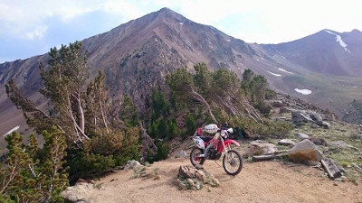
| Ramshorn
Mountain The Lost River Range as viewed from Ramshorn Mountain (9895'). |
 |
| Twin
Peaks Lookout (10,330'). |
 |
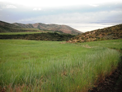
| Gooseberry
Creek Riding high ridges above Gooseberry Creek (7291'). |
|
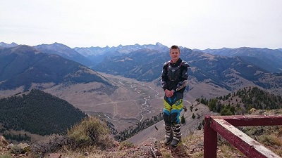
| Sheephorn
Mountain View from the lookout on Sheephorn Mountain (8159'). |
 |
| Taylor
Mountain The view west from Sheephorn Mountain. |
 |
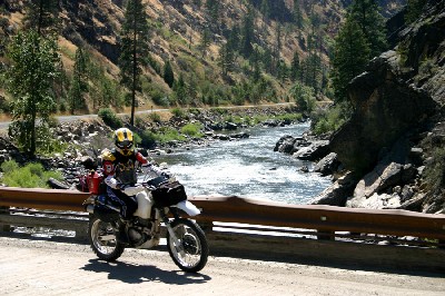
| Salmon
River Crossing the Pine Creek Bridge (4298') over the Salmon River a few miles below Shoup. |
 |
| Stein Mountain Lookout (8555') | 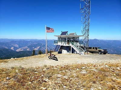 |
| Ulysses Lookout (7649') | 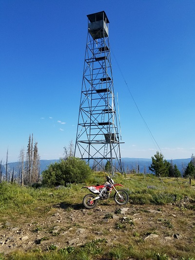 |
| Blue Nose Lookout (8677') | 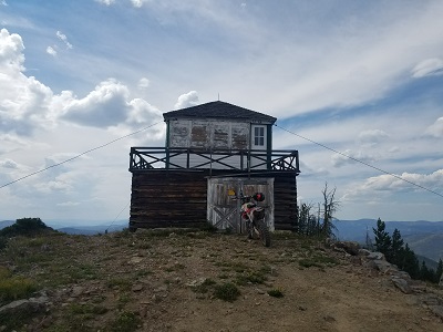 |
| NFD
038 The spectacular 4200' climb from the Salmon River at Shoup to the Montana border (7000'). |
 |
| Beartrap
Ridge NFD 044 along the Idaho-Montana border (8230'). The Salmon River valley is in the background. Twin Peaks, where you were a day ealier, is in the distant background. |
 |
| Magruder
Saddle The beginning of the "primitive road" section of the Nez Perce Trail in the Magruder Corridor (7040'). |
 |
| Salmon
Mountain The top of the 4000' climb from Magruder Crossing in the headwaters of the Selway River to Salmon Mountain (8228'), the high point of the Magruder Corridor. Mile 881. |
|
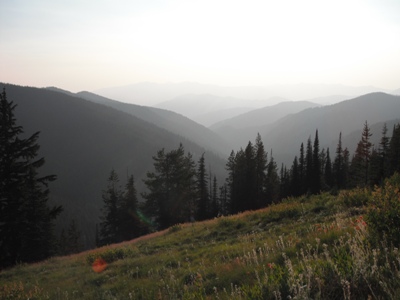
| Dry
Saddle The vista from Dry Saddle (7796'). Beyond Dry Saddle the Nez Perce trail descends some 2700' in just 7 miles to Poet Creek. |
|
| NFD
443 Beginning the long descent into the Selway River Valley at Horse Creek (5400'). Three miles beyond this point the road ends and a spectacular road descends nearly 4000' to the Selway River valley in less than 5 miles. |
 |
| Selway
Falls Nearing Selway Falls (2000'). |
 |
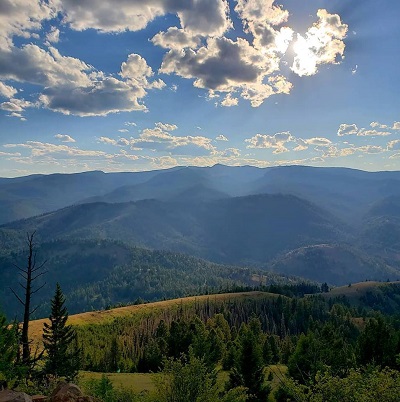
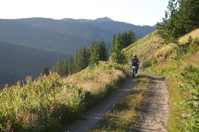
| Lolo
Motorway The view from Indian Grave Peak (6300'). |
 |
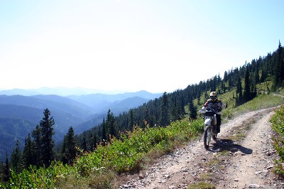
| Fly
Hill NFD 715 on Fly Hill (6074') nearing the headwaters of the St. Joe River. |
|
| Quartz
Creek From NFD715 near Gospel Hill (6140'). |
 |
| State
Line Trail Spectacular scenery abounds along NFD 391, the State Line Trail, here near Craddock Peak (6518'). |
 |
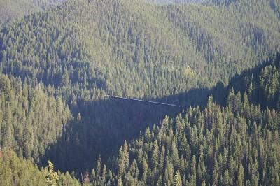
| Roland
Pass An old railroad bridge viewed from Cliff Creek road near Roland (5309') (4500'). |
|
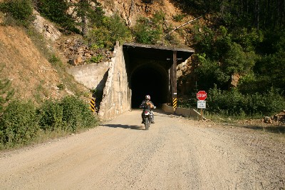
| Moon
Pass Area Tunnel on Cliff Creek Road, NFD 326 (5000'). |
|
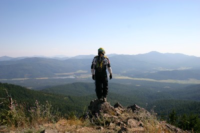
| Hoodoo
Mountain Looking north toward Priest River from the summit of Hoodoo Mountain (5119'). |
 |
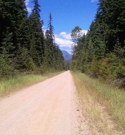
| Upper
Priest Lake A few miles south of the end of T1 on road 1013 (4000'). |
 |
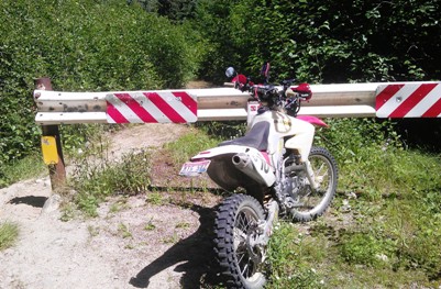
| End
of the line A few miles south of the Canadian Border (4184'). |
 |
| Home | Rides | Reviews | Bikes | Gallery | Tech | Misc | Contact |