| Home | Rides | Reviews | Bikes | Gallery | Tech | Misc | Contact |
| T2
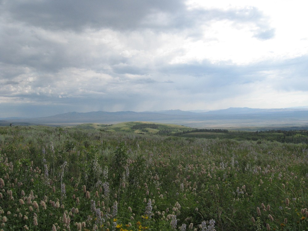
Adventures 2009 Fast Times at South Idaho High By Martin Hackworth Photos by Martin Hackworth, Dan Colvin, Dan Dale Several years ago, shortly after completing the first successful Tour of Idaho, we began to plot another tour - one that would be more manageable in terms of time, more friendly to dual sport riders, and easier to set up for a shuttle. From this was born the Tour of Idaho - T2. After spending much of the 2008 season pre running sections of T2 we were ready for the final blitz in early October. Unfortunately a deluge of biblical proportions put an end to this effort near the end of the first day and we had to salve our impatience to complete the ride with topographic maps and Google Earth over the long Idaho winter months. Spring riding in the Intermountain West is an exercise in resisting the Siren's call. About the time March rolls around the days become noticeably longer, the valleys greener, and the snow level begins to move steadily upward the mountains. It's a cruel hoax for dirt bikers who know all too well that mountain trails are still at least three months away from being free of snow. Though a sunny 85 degree day in May makes those snow patches up in the mountains seem small from the valley years of bitter experience have taught us that they are not. And wait until you see what is waiting in the shade should you kick start your thumper and head into the hills too soon. |
 |
|
|
 |
|
|
|
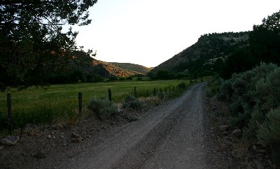
So we bided our time. The first 2009 attempt at T2 was over Memorial Day weekend. With record spring snows we estimated that the chances of success were still low, but hope springs forth eternal and all that. The Memorial day blitz certainly had auspicious beginnings. The weather was ideal and with the exception of one drift at the Knox Canyon/Big Canyon divide it was all smooth sailing on buff and fast trails - at least until the South Hills (near Twin Falls). Massive snow drifts prevented any evident passage around Monument Peak so I was forced to abandon the route forward and backtrack all the way to Oakley Reservoir (though not without some exciting side trips in a search for a way around the snow) and detour around the South Hills on farm roads to the north. By the time I reached the sagebrush flats west of Rogerson massive thunderstorms were looming on the horizon. Oh well, I said smugly to myself, that's what they make rain gear for - though it had the ring of famous last words as it was dinning in my ears... |
 |
 |
Within
15 minutes I was engulfed in winds so strong that the heavyweight
XR650R was being
blown completely from one side of the road to the other. Lightning
bolts as if from Thor himself were crashing all around. I
was in
the middle of the flattest, most featureless portion of all
Idaho very
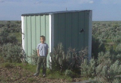
far from either the nearest building or topographic feature. Hailstones
began to rain down from the clouds, thunder cracked,
visibility dropped quickly to zero and help was not on the way. Then, through the maelstrom, I spotted an unlikely miracle - an old irrigation shack - the only irregular feature sticking out of the sagebrush for many miles. I ended up spending the better part of three hours (much of it hoping that my refuge would not get blown down around my head) sheltering from what turned out to be a completely wild and enduring storm - one that I actually began to enjoy after a while from my reinforced Faraday Cage - having to fend off the occasional attack from nesting starlings notwithstanding. |
|
At some
point I heard my cellphone beep and discovered, mirabile dictu, that
the darned thing actually worked way out in the middle of nowhere! This
meant that I was able to both text friends and call for the calvary to
come for a rescue - thus ending 2009 T2 effort number one. I made a second attempt a little over a month later on July 4th. This time I was confident of snow free trails the whole way. My girlfriend and I drove over to Star Valley, Wyoming the night before and spend a great evening at the Wolf Den Motel and Restaurant. We highly recommend the Wolf Den for anyone looking for lodging near the east end of T2. The cabins are really very nice and the rate is the best in all of the area. Six a.m. July 4th arrived with cold, rain and lots of fog. The fog created very poor visibility and it was pretty freaking cold (for July 4th, anyway) cresting the pass near Tin Cup. The roads near Inman Canyon were a little slick but as the sun rose the miles went smoothly and rapidly to Pocatello. A quick stop by the TID flagpole to sign the register and I was off toward the Arbon Valley. |
 |
 |
This time the route over the
Bannock
and Sublett
Ranges, around the City of Rocks and through the South Hills was butter
and I reached Rogerson, the halfway point, around noon. A quick
stop at the Rogerson Store and RV Park (you have got to check this
place out - be sure to ask for Granny) and I was off to the western
desert. This time the grasslands and sagebrush flats west of Rogerson held nothing but clear skies and great weather. Having pre run much of this section of the ride I was familiar with the maze of desert roads and trails leading northwest from Cedar Creek toward Clover Three Creek Road. The miles passed pleasantly and very rapidly. The one surprise was a creek crossing just west of Cedar Creek Canyon, way out in the official middle of nowhere, that was much deeper and swifter than it looked from the bank. What a place to dump a bike - especially a large displacement kick-start thumper. I breathed a sigh of relief when the BRP rose out of the cold deep water to the opposite bank and marveled at a waterline that was only a quarter inch or so below the screen on the airbox. |
|
A few miles from
Cedar
Creek is House
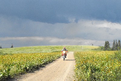
Creek Road and lots of yeehaaah!
This
desert double track is absolutely one of the highlights of T2 (at least
as far as
I
am concerned). It is smooth with great visibility and the only thing
between you and going as
fast as you want is a 1/4 turn throttle. It is possible to average
close to 100 m.p.h. nearly all the way to Coonskin Butte, a
distance
of some
20 miles, in a stunning environment.
At the end of this stretch I spent some time reconnoitering the best route west from Coonskin Butte to Clover Three Creek Road - deciding on a primitive double track that looked to be the most direct route. It turned out to be a mistake involving 7 gates, miles of ruts and many hundreds of head of cattle. Fortunately an alternative that is just a few miles longer (and more scenic and more fun to ride) exists a few miles to the north and has been duly noted for posterity in the gpx files. Clover Three Creek Road is another exercise in restraint from high-speed antics. The difference here is that though CTC is flat, wide, smooth and begging to be ridden at triple digit speeds (with proper gearing and engine displacement, of course) it is also a county road, albeit little traveled, complete with a 35 mph posted speed limit. |
 |
 |
Unfortunately
it is not possible to traverse the 30 miles to Hot Springs Road in,
say, 20 minutes, by rigidly adhering to this needlessly conservative
speed limit. A moral dilemma for sure. Yet in spite of my
internal conflict I do not feel
like a bad person. Somewhere around Bruneau Hot Springs it occurred to me that with the the miles rapidly humming by I could conceivably finish in around 10 hours - not too bad for a 520 mile sighting ride, solo. My pleasant reverie at just this moment was interrupted by a huge washout running right down the middle of Sugar Valley Road, inconveniently located just over a rise, that necessitated a thrilling emergency change of course up the high bank on the left side of the road and some wild side-hilling for about 100 yards or so. The consequences of failing to guess the proper line here (under some duress) would be too awful to even consider. |
|
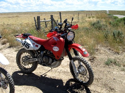
I was fairly
confident that my 7.1 gallon Acerbis
Sahara tank
had the necessary capacity to get me from Rogerson to Jordan Valley
even at high speed so I skipped opportunities to duck into both Bruneau
and Grandview for gasoline and turned southwest on Poison Creek Road,
scorching the eight miles to Poison
Creek Cutoff on the right in just a few minutes. I chose to ride north past Silver City into Jordan Valley. In terms of making time this is a mistake. Although one encounters nothing but improved dirt and paved road all along the way, there is also a lot of traffic - particularly RV's and large pickup trucks living on the edge of death around every corner close to Silver City. West of Silver City the road mellows and turns into a quiet, tree-lined lane with little traffic. I was grooving along, still contemplating the glory of a 10-hour finish when the hallucinating began. I was quite sure that the entire road was moving to the left. A quick squeeze on my oversized front rotor yielded an instant front end slide. When I finally got the BRP corralled I noticed that the appearance of the entire road moving was no hallucination, but rather an optical illusion caused by the migration of tens of thousands of Mormon crickets. |
 |
 |
 |
The remaining scenic miles into Jordan Valley
passed smoothly and rapidly - though it was hotter than a firecracker
once I emerged from the tree-festooned foothills above JV and into the
valley itself. Ten hours was my lodestone and it was
apparent that
only with a dollop of luck and by disregarding all speed limits would I
make my nut.
It was the former that did me in as 1.7 miles outside of
Jordan Valley, in clear sight
of the town and all of it's amenities, the BRP sucked down the last
ounce of gas from the oversized tank and coasted to a halt on the side
of the road. I foolishly wasted about 20 minutes trying to cajole,
wheedle or bribe some gas from the tenants of the farm homes beside the
road - to no avail. Though the lesson had been learned many times in
many circumstances over the years it was reinforced here once again: a
Honda XR650R, though a brilliant dirt bike, makes a piss-poor
wheelbarrow. By the time I pushed the bike a couple of miles to the gas station in JV, in 100 degree heat, the trip timer ticked off 11 hours and 5 minutes. At least I beat my shuttle by 60 minutes. Not too shabby for a day's work. (Note: the current best T2 time is 10 hours and 30 minutes - via a slightly longer and more difficult variant) |
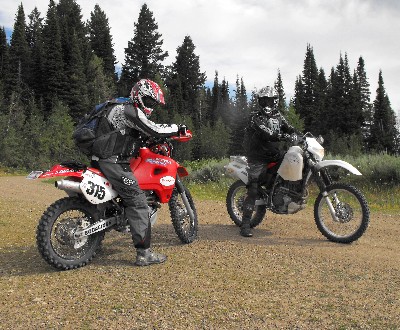
| Having
satisfied my personal need to blaze T2, the next
goal was to ride it again for photos and video. This we did with the
entire MoJazz crew (uh - that would be Dan Colvin, Dan Dale
and
myself) on the weekend of July 25 - 26. We started from Pocatello this
time with the goal of two easy 200 mile days and a fun night at
Jackpot, NV with friends to whoop it up between stints in the
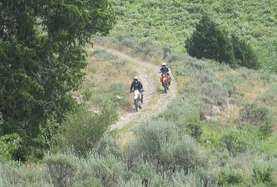
saddle. The first day was pleasant and uneventful. The weather was ideal and brief thunderstorms kept the dust at bay. We shot lots of pics and acquired some great video. We abandoned the regular route west of Monument Peak to ride the ridgeline down south toward Jackpot. Our friends were waiting for us in Jackpot when we arrived. The evening was pleasant and memorable. |
 |
 |
Sunday arrived with nearly ideal weather, clear
skies and
temps in the mid 80's, for riding the desert leg of the Tour. A quick
blast up the road to Rogerson and we were off. A semi-quick blast
anyway. Our colleague Dan Dale, having recently acquired a
well-appointed XR400R, was enjoying his first dirt bike ride of any
kind. An impressive debut to be sure. Curiously Dan managed
to
consistently ride faster in the dirt (the burlier the terrain, in fact,
the faster he went) than he could manage on perfectly straight, flat
paved roads (about 45 mph) and no amount of threating, bribery or
cajoling over two days changed this pattern in the least bit. Dan's
judgment concerning riding seems to be quite set and relatively sound.
His choice of riding gurus, however, probably leaves something to be
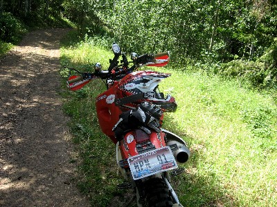
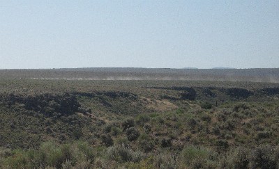
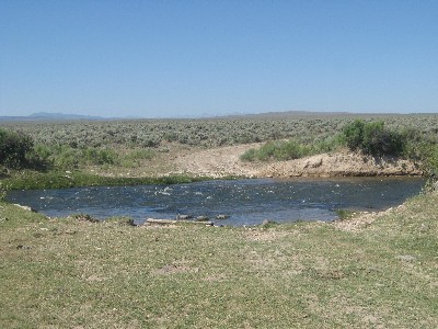
desired. We crossed the Salmon Creek Dam and made our way west to the Cedar Creek crossing without incident. From the Cedar Creek Crossing we rode south along a dirt road that parallels Cedar Creek Canyon to the west. A few miles along this road was the seemingly innocuous creek crossing show in the photo at the left. On my last trip the water had been impressively deep and swift and the crossing had left an impression. I noted that the water level had gone down only slightly in the intervening three weeks. Hmmmm.... |
| I
forded cautiously but the lower water level made
the crossing less dramatic than before. About five minutes later Dan
and Dan came blazing down the road and it took considerable jumping up
and down and waving to keep them both from riding right on across
without even stopping for a brief confab. I showed them the only path
through the crossing free of large rocks and warned them that the water
was impressively deep and the current swift just before the far bank. Just as dirt bikes make poor wheelbarrows (see above), the also make ineffective submarines as both Dan and Dan demonstrated successively mimicking a U-boat and a C-3. The electric start KTM, having ingested relatively little fresh, clear, cool Jarbidge Mountain spring water fired up after minimal fiddling. Having spent a full 30 seconds under water - with the engine running for an amazing amount of that time - the XR400R was another story. We spent 90 minutes drying the airbox, the exhaust, the electrical and fuel systems, the cylinder to no avail. It simply would not kick start in spite of all of our exertions and exhortations. |
 |
| All
good
things come to an end and as Oregon neared
we elected to take the southerly route into Jordan Valley. A
few
twists and turns aside (we have modified the gpx files to show the
minor modifications to our route) I believe that this is the best way -
being both shorter and vastly more interesting to ride than the route
through Silver City. Unfortunately for our shuttle driver James we were about four hours late arriving at JV - especially inconvenient since the five hour drive back to Pocatello would put him in bed about three hours before his 6 a.m. shift at our local coffee hangout, Mocha Madness. To add insult to injury one of us (who shall remain anonymous except for the fact that he's the only member of our little coterie with a PhD in Physics from MIT) pulled away from a rest stop with the parking brake still engaged in James' behemoth F-250 - a truck with enough torque to move the Empire State Building - devouring two sets of pads, a rotor and welding bearings to axle races. This resulting in the most expensive shuttle ride in MoJazz history. Oh well, one one of them had to be. |
 |
 |
 |
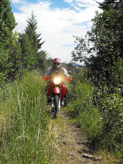
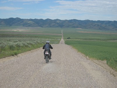
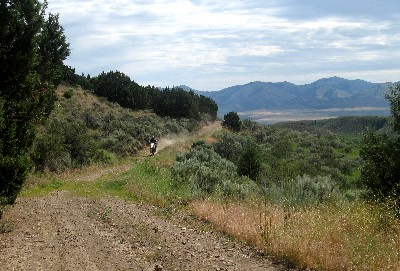
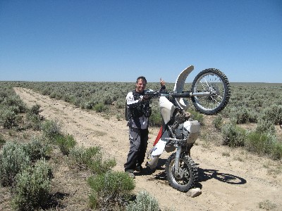
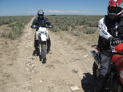
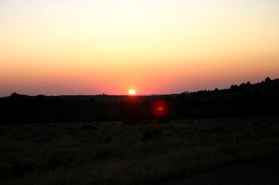
| Photos: Frontpiece) Martin with the laser cannon in Flint Canyon 2) Dan in Arbon Valley 3) JR Hackworth outside the "rescue shack" 4 - 5) Flint Canyon 6) Sublett Crest 7 - 8) Monument Peak area Centerpiece) Deadline Ridge 10) Deadline Ridge 11) Dan's contrail approaching the Cedar Creek Crossing 12) The Jarbidge Ocean 13) Draining water out of the XR400R's exhaust 14) BRP towing, Inc. 15) Hot Springs Road 16) Mud Flat Road 17) A few miles from Jordan Valley 18) Martin and Dan Dale looking spiffy and clean 19) Sunset from JV 20) Photo mule, tow truck, bulletin board, tanker, street legal dirt bike, renaissance motorcycle |
|
 |
T2
Route Description GPS Topos Video: Submarine Bike (5M wmv) 100 mph (65M mp4) Salmon Dam (19M mp4) South Hills (151M mp4) Flint Canyon (275M mp4) City of Rocks (167M mp4) reader forum |
 |
| Home | Rides | Reviews | Bikes | Gallery | Tech | Misc | Contact |