| Home | Rides | Reviews | Bikes | Gallery | Tech | Misc | Contact |
| Big Southern Butte by Martin Hackworth Photos: Martin Hackworth |
|
|
|
 |
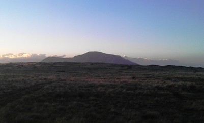
Big
Southern Butte dominates the Snake River Plain north and west of
Pocatello. It's the lone, large "mountain" that one sees in the
distance out in the desert on any clear day. For a dominant landmark
that is so easily visible from nearly all of Eastern Idaho, Big
Southern Butte is very lightly visited. That's a shame. Big
Southern Butte is easy
to find and accessable by foot, ski, mountain bike, motorcycle, UTV,
snowmachine, horseback or SUV. You have no excuse not to go
there. Rising dramatically some 2500' above the surrounding plain, Big Southern Butte is the remnant of an ancient lava dome that has towered over the Snake River Plain for about a million years. From the summit, one may look north east and see two similar rhyolithic domes in a line to the northeast that heads straight toward Yellowstone and the Island Park Caldera. |
|
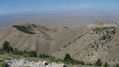
There are many ways of accessing Big Southern Butte, and a
DeLorme or Benchmark Atlas for Idaho will prove to be invaluable for
those wishing to forge their own adventure, but the most common way of
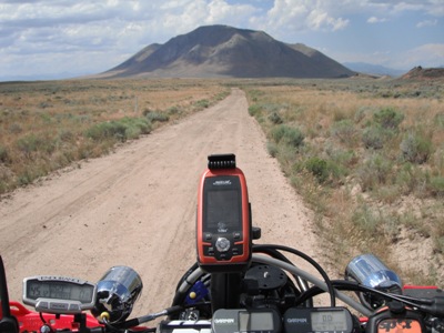
accessing the Butte is from US Highway 26 near Atomic City. From the
Atomic City turnoff it's roughly 25 miles to the top of the Butte. Allow three to five hours
for the round trip
to and from Atomic City. The first 21 miles consists of gravel and dirt roads with only modest elevation changes that are easily passable (most of the year) in nearly any vehicle. From Hwy 26, one travels west, eventually circumnavigating the southern part of the Butte, before heading north along its western flanks to Frenchmans Cabin. It's here that the real fun begins. |
 |
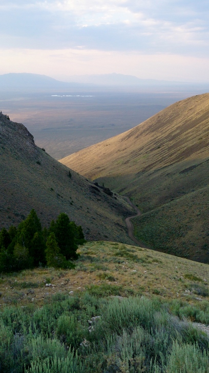 |
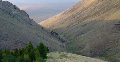
From Frenchmans Cabin, one
heads nearly due
south into a tremendous vale that cleaves the northern face of the
Butte in half. A gate is encountered about a mile up the
road intended to prevent any further motorized
progress when
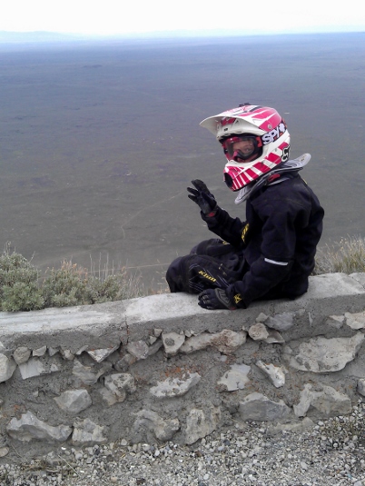
closed during the winter and early spring. From the gate it's a little over three miles to the summit. The road is generally very good, but in some places quite steep. At least some ground clearance and 4WD are probably necessary most of the time. I have driven this road, ridden it (many times) on motorcycles and mountain bikes, and even run to the top once. It's taxing, but rewarding. Please note that the ambient temperature may be around 100 degrees during the summer months. Help is not particularly close by should some crisis come up. Most cell phones will work, but not along every bit of the road. Plan accordingly. The temperatures on the summit are likely to be 10 - 15 degrees colder than those in the desert below, so bring along a windbreaker in order to enjoy the views from the top. You'll want to loiter. On a clear day one may take in a vista that covers most of Southern Idaho and several surrounding states. The sky, on a clear night, is ideal for stargazing. It's one of the best places around to take a small telescope or set of binoculars and spend the night. |
|
About the only drawback to visiting the Butte is
that you
will be confronted to an enormous amount of damage done by vandals.
Most of the signs along the way have been shot to pieces. A fire
lookout that used to sit atop the Butte was recently removed after
years of being so vandalized that it became a safety hazard. |
 |
 |
Big Southern Butte is on the Tour of Idaho. GPS (right click the link and save) Map Trail Profile Reader Forum |
| Home | Rides | Reviews | Bikes | Gallery | Tech | Misc | Contact |